|
| Northshore Peak on Approach - Spring Mountains in Far Distance |
 |
| View from Kay's Saddle to Red Wash |
 |
| From Northshore Peak Ascent to North Bowl of Fire to Muddy Mountains |
 |
| Climbing past the Landmark Outcropping (Behind Ed & Anne) |
Northshore Peak is said to be the highest peak that is close to Northshore Road. Located in the Lake Mead NRA, it rises sharply 3294 feet above sea level; around 2000 feet above the surface of Lake Mead that can be seen in the distance from the climb. Until 2016, the club has made an annual trip up to the top to see the unbelievable views of the Bitter Spring Valley and westward to the Spring Mountains. We skipped a few recent years so, today, seven club members got out there. This time, instead of doing the regularly used 5 mile loop over a steep saddle to end the hike, we drew a new route on the map that uses a much more gentle saddle and colorful area to complete a 6.3 mile adventure.
 |
| Starting up Second Tier |
As part of the Hamblin Bay Fault, Northshore Peak lies south of Northshore Road at mile marker 20.5. This is the Northshore Summit Trailhead parking area with restroom.
 |
| Traverse near the Top of the Ridge |
Since none of us had climbed Northshore Peak in recent years, we followed a GPS track from the past. It's fairly straight forward.
 |
| Rita arrives at Top of Limestone Slab |
 |
| Color Galore! |
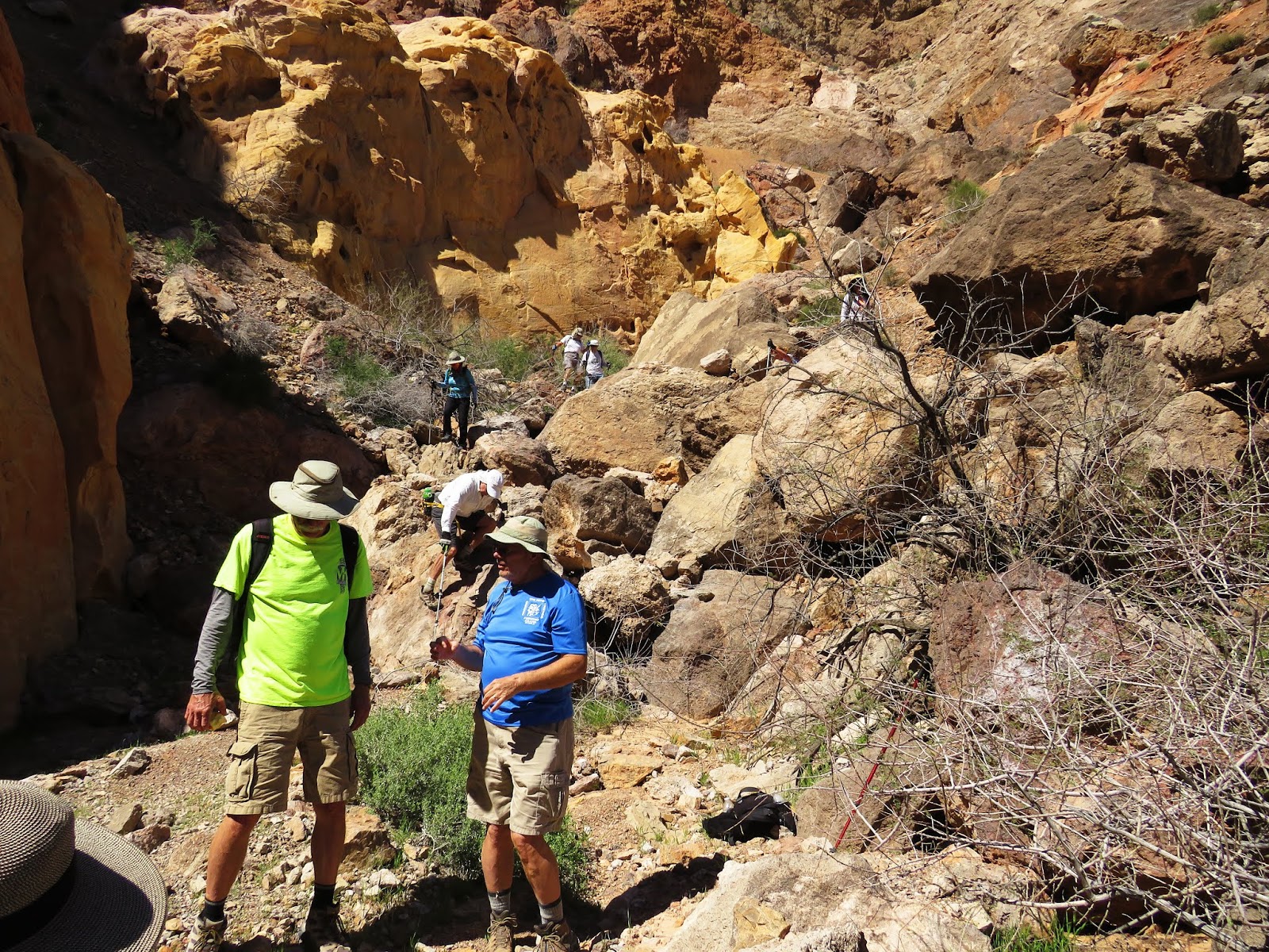
There is a landmark rock outcropping (round & approximately 25 feet high) sitting on a trailing ridge from the mountain about 0.4 miles from the parking area across the road. This landmark will be useful at the end of the hike as well. We crossed the desert terrain making our way down and up a few arroyos until we reached the outcropping then continued straight up the ridge. The first tier of climbing involved a solid rock and brush hillside. At the top, we found our first cairns. I can't promise these cairns will always be there, however, they led us on an obvious circle around a cliff on the right. Next, the second tier of climbing involved a desert and rocky hillside with a few broken cairns on the way.
 |
| Northshore Peak Photo |
The cairns would lead us on a continuous climb up through the mountain desert terrain but we opted for a slightly left shift over to a long steep sticky limestone slab. We like slabs!
 |
| Trailing Knife-Edge from Peak |
At the top of the slab, we were nearing the top edge of the ridge. So, we turned to the left and started a long diagonal traverse. The "wow" factor was really kicking in with fascinating views of the desert below the mountain's steep cliffs.
 |
| View Southwest from Peak |
 |
| Dropping back down the Scramble |
Just before reaching the peak, there is a drop down (use the lower cairn) to a gulley, a climb through a sheep bed against the wall, a cliffy saddle, and then a scramble (easy) up the other side of the gulley. (See scramble to left.) A few more feet and we were there at the peak taking photos and signing the log. We had taken the climb at a reasonable pace and I found that it wasn't nearly as taxing as it was the first time I did it. We took a short break then headed down. Our target for the descent was the wash saddle at the mountain's south base. We retraced our steps until we reached one of the "gulleys" where we turned to go down to the top of a large dry fall. Veering to the left put us in a perfect place to complete the descent.
 |
| Hiking down wash to Interesting Canyon (3 Caves behind in Northshore Peak) |
At the saddle, we turned right and hiked down the small wash filled with rocks and a vague trail. Up to our right shoulder, we noted the three large caves in the side of Northshore Peak ridge.
 |
| Starting down Interesting Canyon |
These caves and another one nearby have been previously explored by Chuck and friends. They found that the caves have been used as campsites in the recent past.
 |
| Interesting Canyon Rock Layers |
 |
| Slab Down Climb |
The small wash comes to a fork where we took a left through a curtain of rock layers. We immediately dove down a very interesting wash decorated with tilted layers of eons of geologic upheaval. A geologist would enjoy spending a day just in this canyon. It is navigable all the way from top to bottom in spite of all the rain we have had this year. A pleasure! Then, we drooled out into the Razorback Wash North as the high walls gave way to a view of the Razorback Ridge. Here, a left turn started us up an easy sand wash that wiggled slightly right and left. At about 3.5 miles into the hike, we stopped for our long break. Next time, it might be nice to stop a little further on so we could sit on the wash saddle and study the surrounding terrain.
 |
| Princes Plume near Canyon Mouth |
The approach to the wash saddle is haphazard; a little counter-intuitive. The main wash comes to a fork where you must take a left then an immediate right. Here is where it becomes obvious that the Razorback Wash North used to be an old mining road.
 |
| Hiking up Razorback Wash North |
The previously used loop saddle (Chuck's Saddle) to return back to the cars is seen up to the left (north) from the wash saddle. On the other side of the wash saddle, the road/wash begins a gentle descent.
 |
| Northshore Peak from Razorback Wash North |
 |
| Open Sun Ray |
We passed wildflowers, views of Northshore Peak and colorful sand hills covered with cryptobiotic soil. Razorback Ridge rose high above us to the south and over the eras of changes in the earth, erosion, likely, has sent some of the humongous boulders down the ridge and into the wash terrain. The boulders were intimidating as we circled around them. Some hikers found "animals" and such in the form of rocks and boulders of the area. As washes go, this one was easily hiked and beautiful in its offerings. One and a half miles from where we entered the wash at Interesting Canyon, we came to Claim Junction.
 |
| Large Boulder that Rolled down from top of Razorback Ridge |
We knew we were nearing our turn when we came upon a post on the left side of the wash. Next, we noticed a "dig" and tailings pile in front of it. We can only assume that this was a mine claim and an attempt to hit it big!
 |
| Razorback Ridge Above |
A peek at the GPS told us that this was also our left turn wash we were expecting. Looking up at the high ridge to the north, we could not see the low saddle we sought. Perhaps it was hiding.
 |
| Claim and Old Dig at Junction Left |
 |
| Starting down from Kay's Saddle into Red Wash |
Trusting the GPS and the route I had added to it, we took a sharp turn to the left and started up a small rocky wash that held another mining claim post. Next, we came upon an old tortoise shell. We were excited about seeing the shell and missed the right turn into another wash. It turned out that this was a good thing since climbing up the right side of our small wash to regain the route was easy and painless. Then, lo and behold, a shallow saddle (Kay's Saddle) appeared before us! We traversed over to it and took in the beautiful view as seen in the second photo of this entry. From the saddle, the Red Wash dropped gently in front of us. We followed down into the color.
 |
| Gypsum Fins at side of Red Wash |
There is only one dry fall in this wash and it can be seen below. It is in a sensitive area with protruding fins and cryptobiotic soil. We had to go around to get down the first part and we were very careful. In retrospect, there was a side wash we could have taken several feet back.
 |
| Fun little Step Down among Fins |
Red Wash is beautiful in color, plants and soil. Always be careful when hiking through sensitive areas such as this. Finally, when our eyes were filled with color, we came to the junction of the Northshore Wash. This is around 0.6 miles down from the saddle.
 |
| A species of Buckwheat, perhaps? |
 |
| Red Wash / Northshore Wash Junction |
A left turn into the Northshore Wash gave us the photo to the left with Northshore Peak rising in the crosshairs. The wash led strongly and soon, the walls began rising higher and higher. Yep, it was an unescapable slot for several yards! Then ... we came to a large (
maybe climbable) dry fall. Phew! A perfect escape route appeared to the right and out we climbed! Joy! At the top of the escape, we were in the perfect position to make our way over to the landmark outcropping and back across the arroyos to the cars. This was an exceptionally fun adventure today with hikers ready for the task! Perfect weather, too, BTW!
6.3 miles; 1450 feet elevation gain; 4.5 hours; average moving speed 1.4 mph
 |
| Heading into the High Walls of Northshore Wash |
 |
| Climb Out of Northshore Wash |
 |
| Return to Trailhead |