Thursday, September 29, 2022

South Loop de Loop with Extra - 9/29/22

Aspens in Peak Color at the Echo Cliffs

Rock Outcrop at the Ridge Overlook of Rainbow Saddle

Little Falls

On Break at the Ridge Overlook
I didn't take my real camera because I didn't think this hike would have such wonderful views. Boy, was I wrong! Six hikers started up from the Echo Trailhead and connected with the South Loop Trail. At Rainbow Junction, one mile up from the South Loop Trailhead, we turned to the left. At the top of the hill, we turned right and headed up the ridge until we reached a large rock outcrop. Here, we had a great view of Rainbow Saddle. Someday, I really wish a trail will be made from this ridge up to the saddle. Since the Carpenter I Fire in 2013, there has not been a decent way to climb Harris Peak. This route would be great but, right now, there is too much fallen debris in the way. We came back down the ridge and turned right onto the old fire road. Although I have hiked this fire road loop twice since the fire, at this point, it is almost impassable on the top side. We climbed over the hill to connect with the lower side of the loop and finished the circle. After descending the South Loop Trail and continuing over the Echo Trail, we took the Little Falls Trail up to see the running water. We passed this adorable group of three women and nine young kids who were also climbing up to see the waterfall. It was a very enjoyable day.

Stats: 5.5 miles; 1600' gain; 3.5 hours

Harris Peak and Rainbow Saddle from Ridge Overlook

Six on the Trail (add Mike)

Enjoying another Break at Little Falls


Tuesday, September 27, 2022

Wallace Canyon Split Rock Double Loop - 9/26/22

View of Mt. Clinton from Top Rock near Split Rock

Wallace Canyon and Pahrump, NV Beyond

Peak Season for Autumn Color

Bob and Mike heading up the Trail
The aspens in Lee Canyon were at peak autumn color as three club members went on a "bushwhacking tour" into Wallace Canyon. Well, not really. But, ... the horse trails leading along the traverse of the southeast ridge of Wallace Canyon were in very bad shape due to deadfall and rain damage. It doesn't appear that hikers have been using this route very often to get to a beautiful view of the Pahrump Valley at a place we call "Split Rock." There are also close views of Mt. Clinton and Mt. Reagan just beyond the rock fin ridge. The Pahrump Overlook Peak and Amargosa Overlook Peak ridge line are on the opposite side of Wallace Canyon and that view dominated most of this entire hike. Regardless of the necessity of bushwhacking at times, we enjoyed trying to follow the off and on trails! Trail cairns would be welcome here, me thinks!

Mummy Mountain from Wallace Trail

Mike and Bob on Wallace Saddle

Looking over the 1978 Plane Crash Memorial where one man Died

Bits and Pieces from the Plane
We began from the Upper Bristlecone Trailhead and hiked up the trail one mile to the No Name Trail junction. After a left turn here, we hiked up another approximately quarter mile to the Wallace Trail junction and forked up to the left. This began a very steep climb with an open view of Mummy Mountain at the gain of the ridge. Next, the trail continued its steep ascent up the ridge mercifully zigzagging at small intervals. Finally, the trail takes a decided turn to the right and traverses over to the Wallace Saddle, a beautiful point to take in views all around. We dove over the other side of the saddle and followed the trail as it turned to the left. This part of the trail is still relatively easy to follow as it leads to the 1978 plane crash site.

One of Several Wash Crossings

Mt. Clinton (Right) and Mt. Reagan (Left)

Kay peers down Wallace Canyon from Top Rock

Mike and Bob on top of Top Rock
Arriving at the site, we observed the memorial that consists of bits and pieces of the airplane. The plane was removed a few years ago but hikers still make the trip to the site to pay respects. For a photo of the plane before it was taken out, go to: http://aroundthebendfriends2.blogspot.com/2013/08/wallace-canyon-plane-crash-loop-8413.html
The trail continues diagonally up in the 10 o'clock direction then begins crossing a series of drainages flowing down from Lee Peak. It is difficult to follow the trail at this point but, suffice it to say, there is more than one trail that leads across the traverse. When we lost one trail, we would continue on a slight diagonal up until we found another trail!

Devil's Thumb from Top Rock

Mike on top of Split Rock

View back at Wallace Saddle from Split Rock

Vague Horse Trails lead the Way
Finally, we found ourselves nearing the Top Rock of the rock fin ridge that contains Split Rock. We headed up to the Top Rock and took a few photos. A cairn is built on the Top Rock that rises ~200' higher in elevation than Wallace Saddle. Afterwards, we dropped down beside the rock fin and ended at the Split Rock where we took a break. Here, you see Pahrump from one side of the split and Wallace Saddle from the other side. Ready to go again, we followed the trail that drops down to regain the traverse. For some reason, the trail has always been a lot easier to follow on the return. Upon crossing one of the washes/ravines, it is good to find the upper trail that bypasses the plane crash site.

Crossing at Large Ravine

Deadwood covers the Trail in Several Places

Arriving above Wallace Saddle

Lee Canyon from Horse Trail to No Name Trail
This upper trail will take you back to the ridge above Wallace Saddle that leads to Lee Peak. The route prevents you from having to climb steeply back up to the saddle on the return. We had to search for the upper trail this time but, it was worth it. We gained the Lee Peak ridge and dropped down to the saddle on a trail then continued straight and around to the right. There is a horse trail that we had used several times that takes you on a traverse over to the No Name Trail. Last time we took this trail was before the exceptional monsoon season this summer. Wowie! The trail has been all but obliterated in a few places. We found ourselves side-hilling and searching. However, we were able to "follow" the trail all the way to the No Name.

Horse Trail to No Name Trail

Descending No Name Trail

Autumn Aspens on Upper Bristlecone Trail

Kay hikes through Aspens

We connected with the No Name Trail a few yards down from the No Name Saddle and turned right. Hiking down the trail, we noticed that this trail was also affected by the monsoon season. But, wasn't it great to get a bunch of rain! A right turn onto the Upper Bristlecone Trail came next and that was when we started seeing other hikers. They were all out enjoying the autumn colors. When we were able to see down onto the ski slopes, the aspens appeared as if someone had dropped splashes of yellow paint here and there from above. Ah, nature! Simply lovely! ... And, a fun day!

Stats: 5.5 miles; 1550' gain; 4.5 hours

Aspens on the Upper Bristlecone Trail

Still talking 5.5 miles Later

Nearing Upper Bristlecone Trailhead


Wednesday, September 21, 2022

Lower Showgirl / Powerline Road Loop - 9/19/22

Kay & Ralyn on Wooden Pole Powerline Road

For an exploratory hike on a coolish day, three of us parked at the Lower Showgirl Trailhead, dropped down the hill and hiked under the Kyle Canyon Road bridge. We followed the Showgirl Trail winding up through the desert hills for ~1.5 miles. Here, we turned right onto Forest Road 577, aka Wooden Pole Powerline Road. This is a very steep rocky road that climbs up a ridge and ends at Angel Peak. After turning left at a junction, we climbed and climbed as the steep ridge undulated. At around 3 miles, we junctioned with a spur road of 577. Seeing that our expectations were realized and the road was almost too steep to hike down, we continued out the original road for another quarter mile where a much gentler ridge headed down to the right. Bushwhacking, we found our way through a lot of brush and some clear spots and ended up at the bottom of the hill in the canyon where another forest road ran through. This canyon road was very pleasant to descend. Picking up a lot of campsite type trash along the way, we continued down this road until we reached Kyle Canyon Road just east of the cars at the trailhead. It was a great workout with a very nice breeze to ward off the sun. Fall is coming!

Stats: 6 miles; 1600' gain; 3.5 hours


Sunday, September 18, 2022

Lee Canyon Narrows (Easy Moderate) - 9/17/22

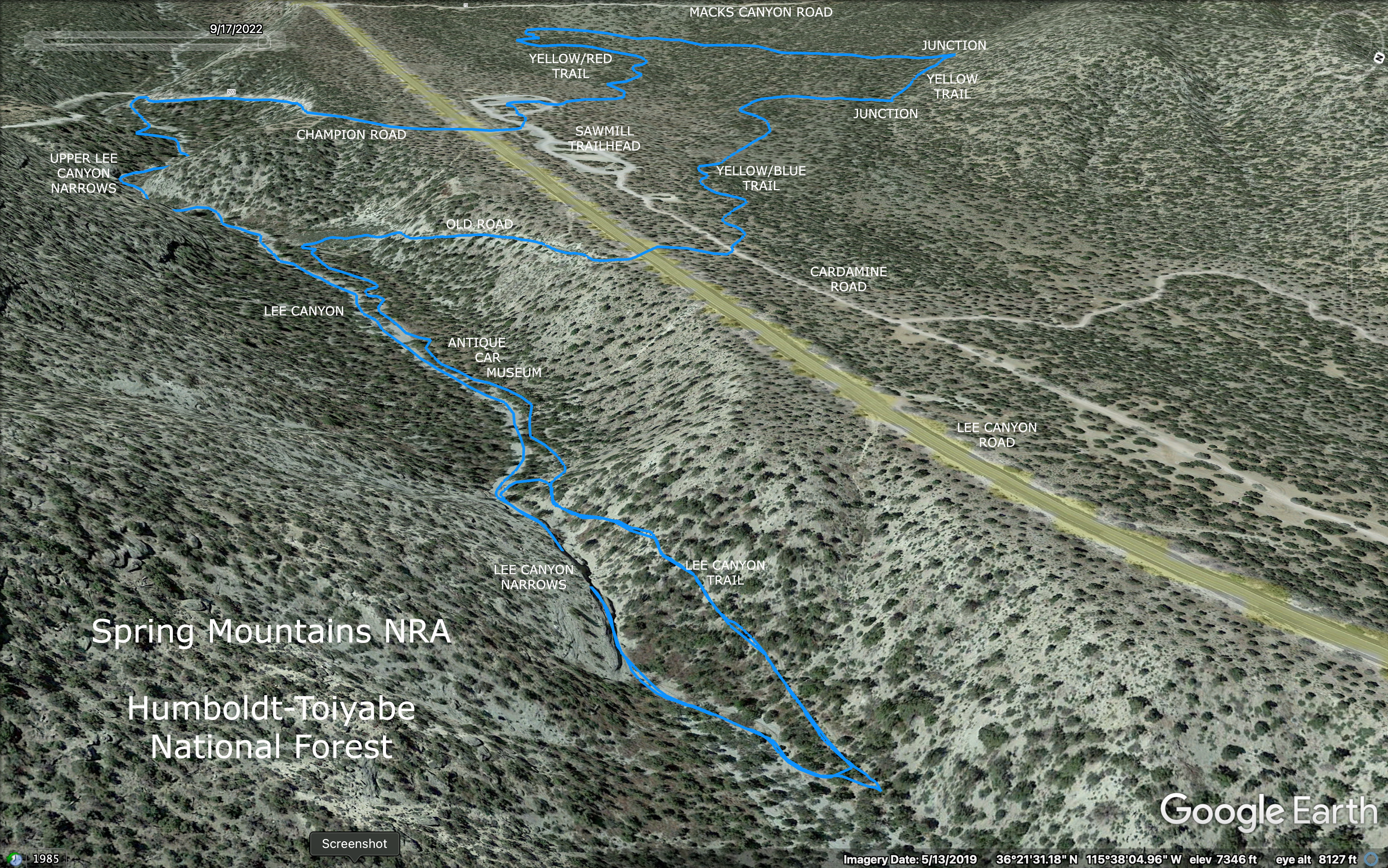
Mummy's Head from Lee Canyon Trail (Narrows down to Left)

Obstacle Rock from top of Narrows

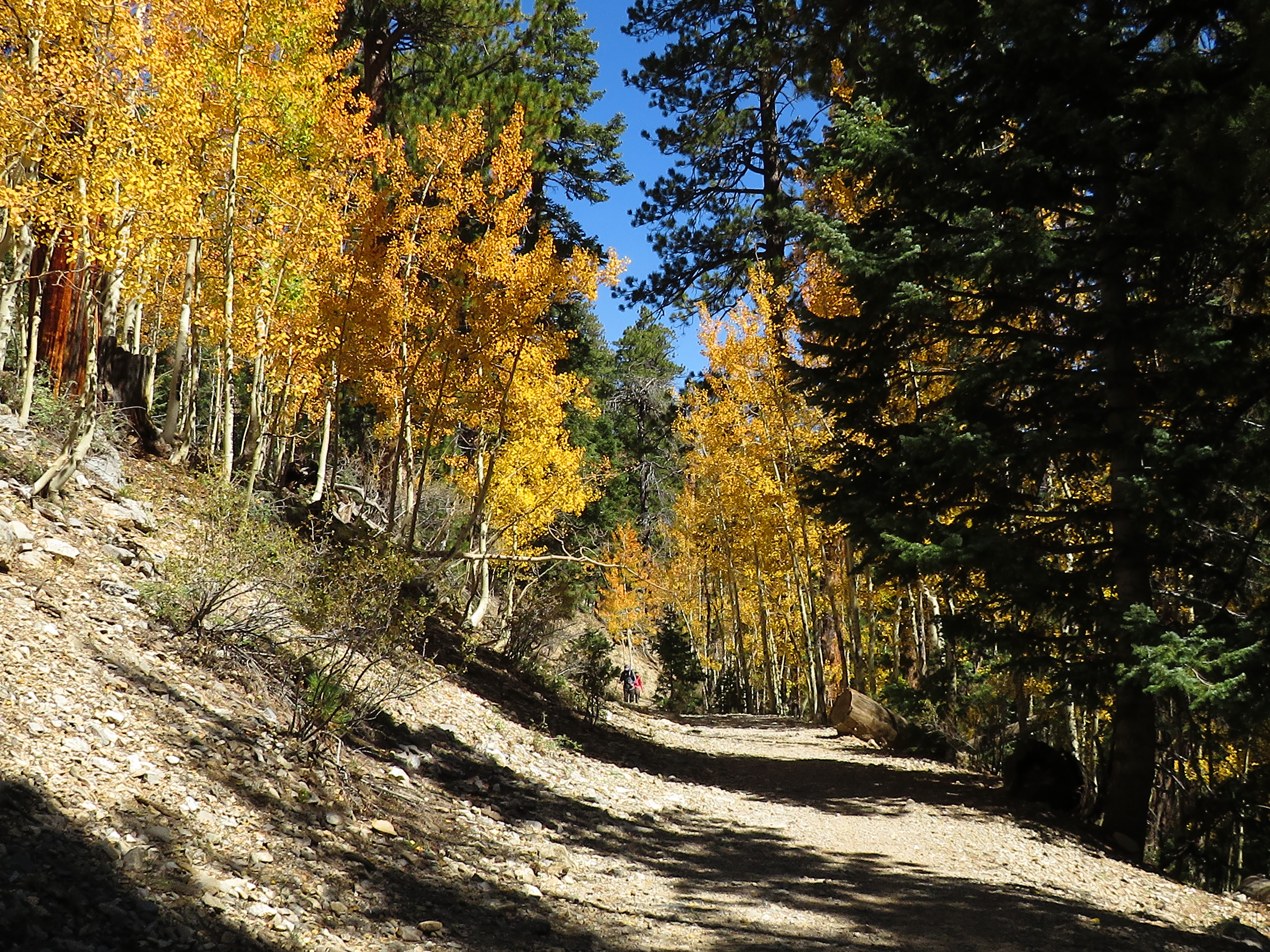
Antique Car Museum on Lee Canyon Trail

Turning down Lee Canyon Wash
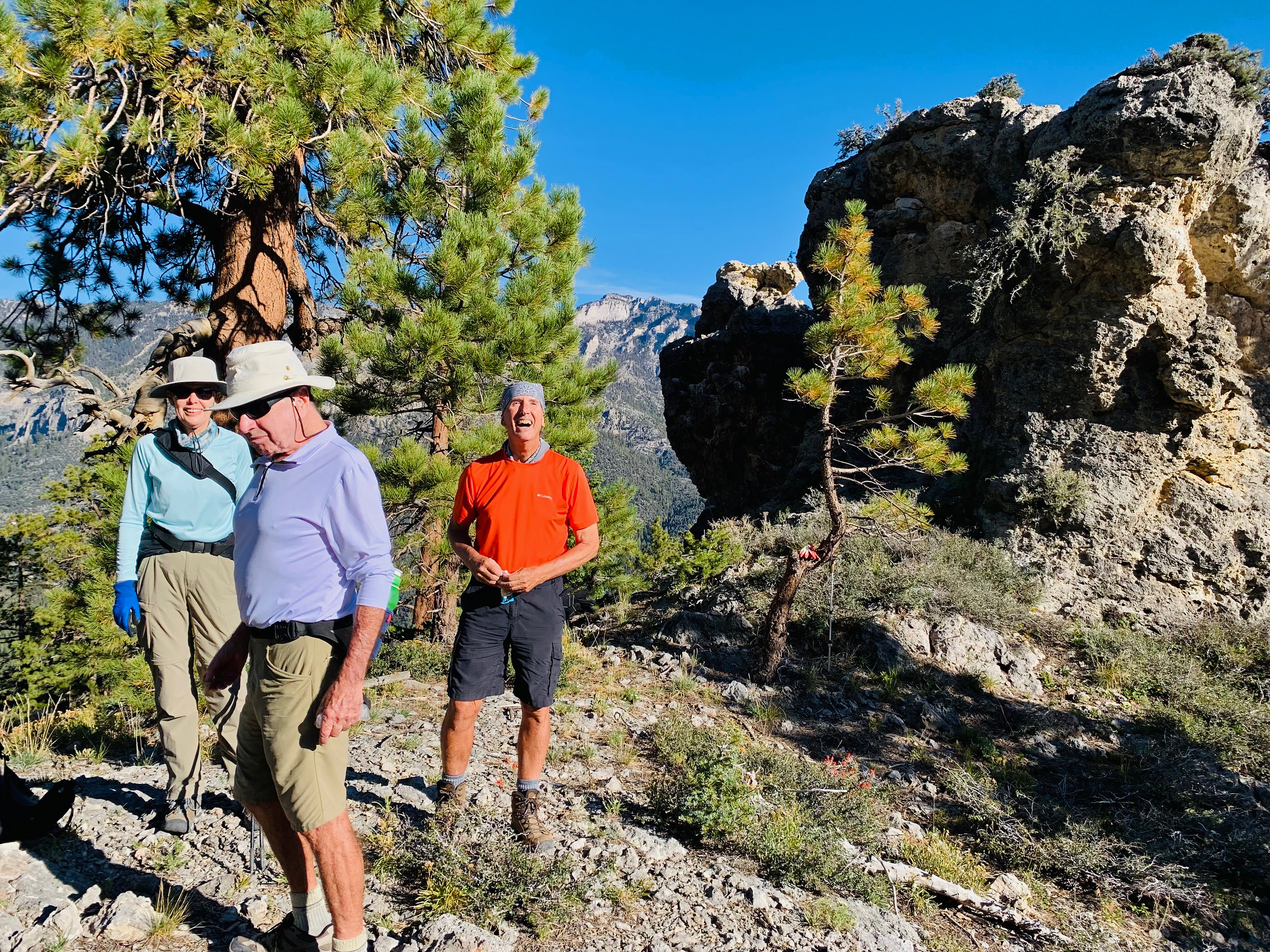
Fourteen and a half (Odie) hikers arrived for an easy moderate hike into Lee Canyon and up around through the Sawmill Trails. It was a beautiful cool morning. We started out the entrance to the trailhead and crossed the road onto Champion Road. This road dips down into the Lee Canyon wash where we turned left to hike down through the gravel. Lee Canyon is a deep canyon that runs all the way down 17 miles from the ski slopes below Lee Peak to SR 95. Sawmill Trailhead is located 4.5 miles from the top and already, Lee Canyon is almost 100 feet deep. The canyon deepens to 150 feet at our lowest point for the day at the narrows. We hiked down through the wash with the first point of interest being the upper narrows.

Upper Narrows of Lee Canyon

Enjoying Lee Canyon

Antique Car in Lee Canyon Wash

Wash narrowing Down
The upper narrows are bound by tall walls with pinnacles and windows in the caliche conglomerate. However, these narrows are wider apart than the lower narrows. We continued down and passed the antique car that lies in state within the wash. Every year it has different amounts of gravel inside and covering the outside. Shortly after the car, we came to the top of the lower narrows as the rock walls closed in. We stopped short at a fifteen foot drop and took a look at Obstacle Rock blocking the slot entrance. After everyone had a chance to see the view, we returned up wash about 25 yards and turned to our right to join the Lee Canyon Trail that passes the narrows by going up and around on the hillside above.

Hiking into the top of the Narrows

Bottom of Narrows

Tiny Flowers and Fauna

Fourteen & 1/2 in Lee Canyon Narrows
Rain has washed this trail on the lower end of the hill so rocks and ruts made the going difficult. We got to the lower end of the narrows and entered the walls. Lots of oohs and ahhs! Almost everyone ducked below Obstacle Rock to see the big drop we had visited from the top. Then we took a moderate break and our group photo inside the cool cavern-like slot. Returning up and over the steep hill, we continued up the Lee Canyon Trail to pass by another old car, some rusted tin cans, a huge very old tire and one more buried old car. Here, we turned to the right onto an old road to climb back up to Lee Canyon Road. There is a continuation of this old road on the other side of the pavement that soon crosses Cardamine Road. For a shorter hike, turn left here.

Trail above the Narrows

Steep Up & Around

Sunlight through the Trees

Really big Tire!
Just across Cardamine Road, there is the Yellow Trail junction. We started up the trail that first circles one end of the Sawmill Equestrian Trailhead. There are a couple of left turning trails that will bring you back to Sawmill Trailhead quicker but we bypassed both of them. We were ascending on a gentle slope and finally came to where the Blue Trail entered in on the right side. Staying on the Yellow Trail, we veered to the left and climbed a little more as we enjoyed getting a little more workout. We could see the Sawmill ridge above us and Mummy's Head behind us since we were about halfway up the elevation to the ridge. Circling around, we came to the Red Trail junction that turns to the right. We waited for hikers to pass by.

View down Lee Canyon

Climbing out of Lee Canyon

Sawmill Ridge from Yellow/Blue Trail

Hiking Up
We turned to the left staying on the Yellow Trail and began our undulating descent. This part of the trail swings out toward Macks Canyon Road and back to the Sawmill Trailhead. The mountains had come alive with visitors. We had enjoyed the best part of the morning! Excellent easy moderate hike!

Stats: 4 miles; 600' gain; 2.75 hours

Yellow Trail

Hiking Down

Returning to Sawmill Trailhead