Monday, January 30, 2023

Lone Grapevine Spring / Burro Trail Loop - 1/28/23

Petroglyphs found near Lone Grapevine Spring

Fence and Petroglyphs at Lone Grapevine Spring

Heading out toward Windy Peak

Using the Bike Trails
In doing a little research for this blog, I came to the conclusion that the springs we visited in Cottonwood Valley have different names than what I was introduced to them as. Fifteen years ago, I was told that the spring located in the foothills beneath Hollow Rock and Windy Peaks (southernmost) was named Lone Grapevine Spring. Just north of this spring where many petroglyphs have been written, there is another spring that, for many years, I thought was called Muddy Spring. Hmmm. I learned that the Muddy Formation doesn't come close to this area. Anyway, I remembered that Jim Boone had tried to correct our club's usage of those names a few years ago so I looked up his entry on his site, Birdandhike.com. Considering Mr. Boone to be the authority in this instance, I will adopt the names he gives each of these springs. The southernmost spring is named Wooden Fence Spring and the spring just to the north is the actual Lone Grapevine Spring. Consider this my correction to any previous entries on this site; and, ... there are many. Thanks.

Mike hiking out ahead to base of Windy Peak

View up Cottonwood Valley from Spring Area

Wooden Fence Spring Area below Hollow Rock Peak

Checking out Trails in the Spring Area
The Fearsome Foursome parked at the Late Night Trailhead on SR 160 east of the Red Rock escarpment. It was already a busy Saturday as all the trail bikers prepared their ride. Our route to the first spring, Wooden Fence Spring, took a direct aim at Windy Peak after we circled around the hill next to the parking lot. Windy Peak is the second prominent peak from the south end of the escarpment, kind of roundish. The network of bike trails are laid out all over the valley among dirt roads. It is easiest to just go straight for Windy on trails than to figure out where to turn right or left. When you reach the other side of Cottonwood Valley, you cross one last dirt road where there may be cars parked to the right, and dip down into the terrain. We ran into two mudholes on the trail before we could reach the Wooden Fence surrounding the spring area. Another landmark to look for is a smallish area of dark colored dirt and rock to the spring area's right. If you see cars parked as we did, these hikers are likely climbing the east side of Windy Peak; a strenuous climb.

Canyon between Hollow Rock and Windy Peaks

Dry Water Trough below Lone Grapevine Spring

Ancient and Cowboy Petroglyphs near Lone Grapevine Spring

Rita checks out Ancient Petroglyphs
After exploring this spring area, we found the trail that continued north to Lone Grapevine Spring. We found the wildlife water trough to be bone dry. Did the pipe break or is it frozen? We explored the petroglyphs and took a break. Next, we continued down the wash and found the burro path leading further north. It isn't easy to find but the hoof prints are unmistakable. (We saw a large "harem" of burros outside the fence near Blue Diamond on the way out but we never saw burros on the hike. We knew they were out there!!) The burro trails led us to the large and deep Windy Peak wash. Here, the trail leads east a little before we found the burro crossing. On the other side, we continued to find burro trails but they went in a couple different directions. Knowing we wished to head northeast to run perpendicularly into the Black Velvet bike trail, we found a burro trail for that, too! Turning right on the well worn bike trail, Black Velvet, we dipped back through the shallowing Windy Peak wash and headed back to the trailhead on the usual route. A good workout. Nice day. It's always fun to go check on the petroglyphs. ... Y'all keep down the defacing, will ya?

Stats: 5.5 miles; 700' gain; 3.5 hours

Vague but Clear Burro Trail leading north from Lone Grapevine Spring

Deep Windy Peak Wash Burro Crossing

Fearsome Foursome in Windy Peak Wash further Down

Following the Bike Trails back to Trailhead in Cottonwood Valley


Friday, January 27, 2023

Firehouse Hill Loop - 1/26/23

Firehouse Hill from Yellow Sandstone Feature

Firehouse Hill from Wash at Base

Desert Trail next to Red Rock Wash

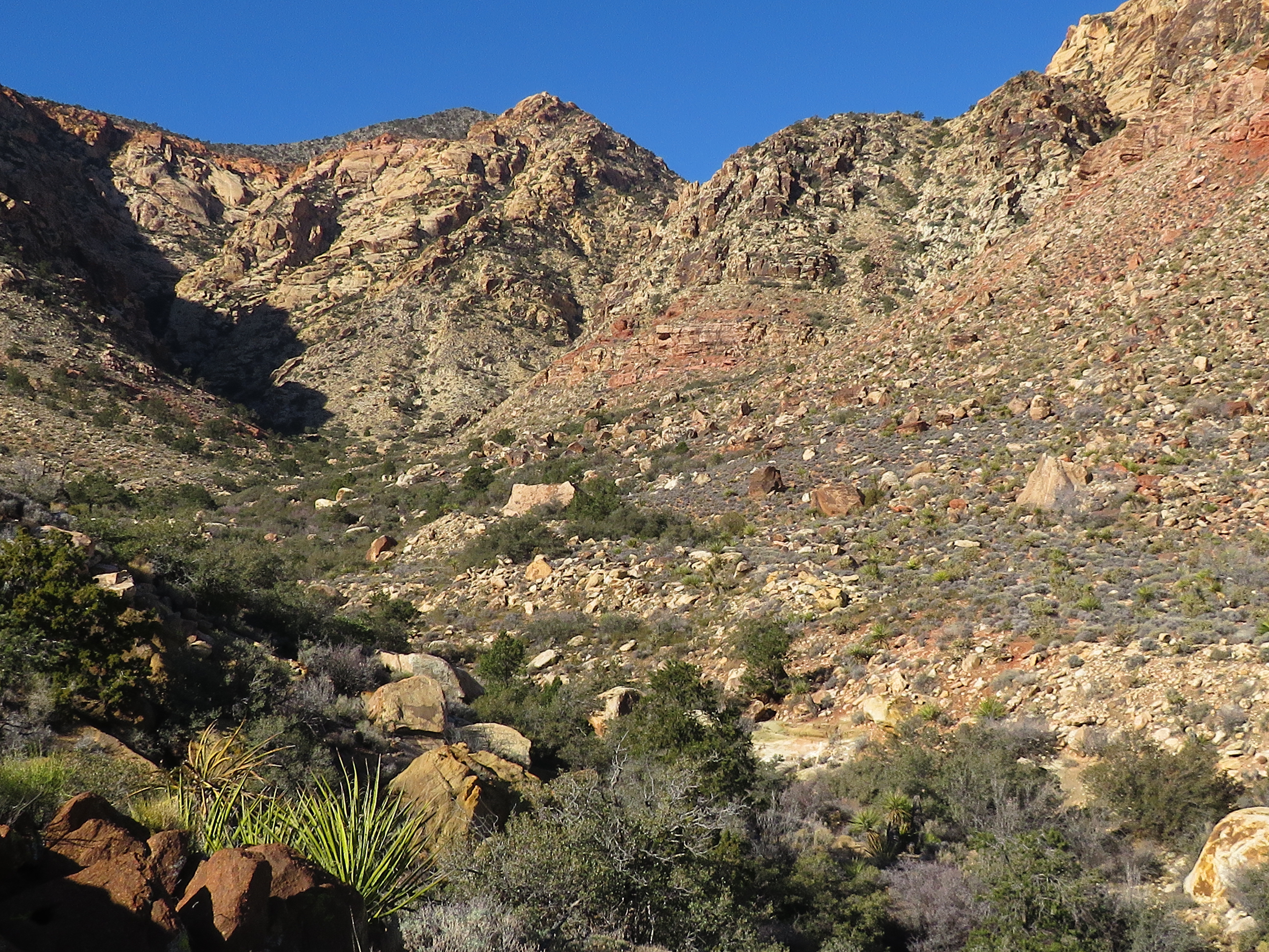
Calico Hills from Desert Trail
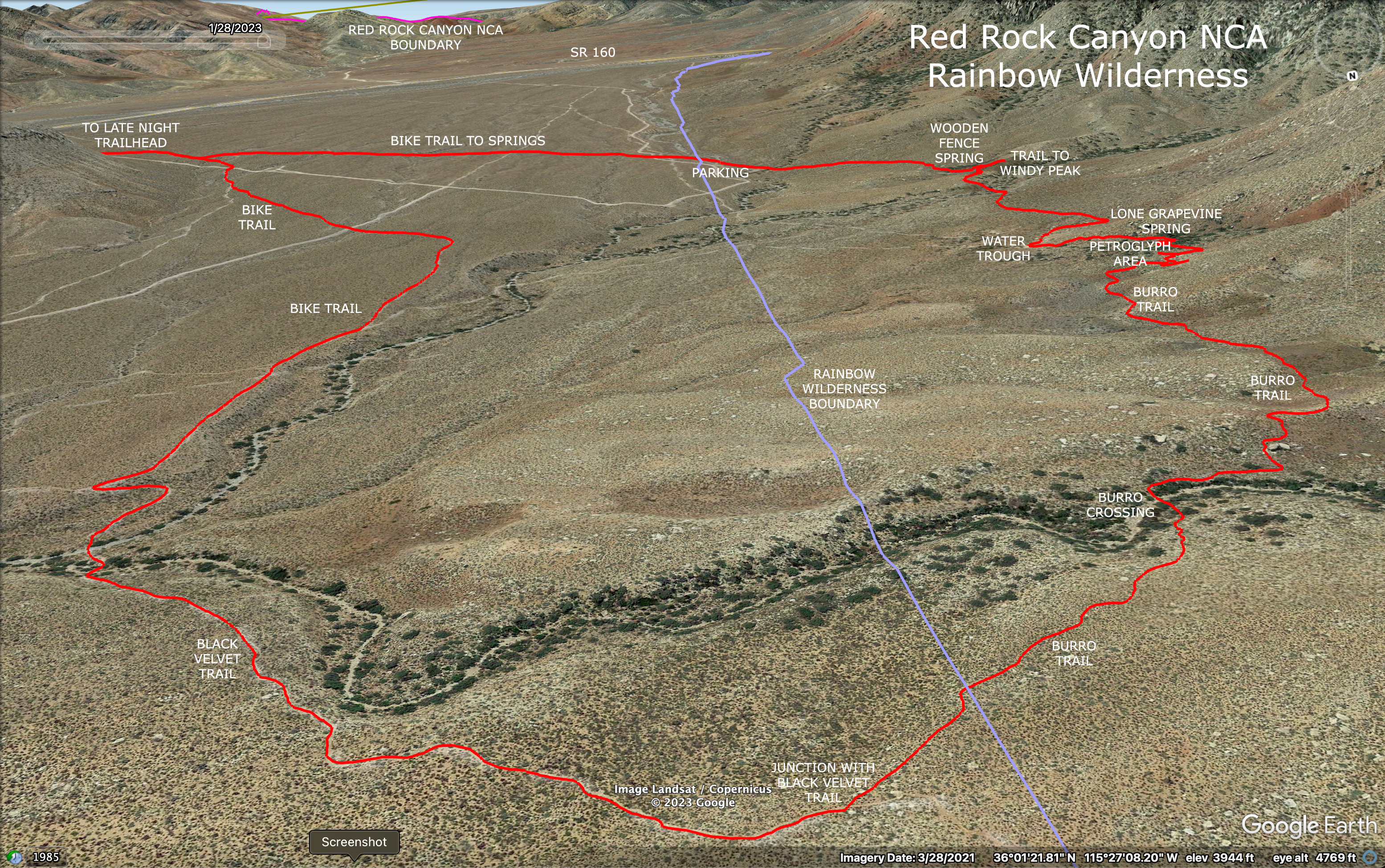
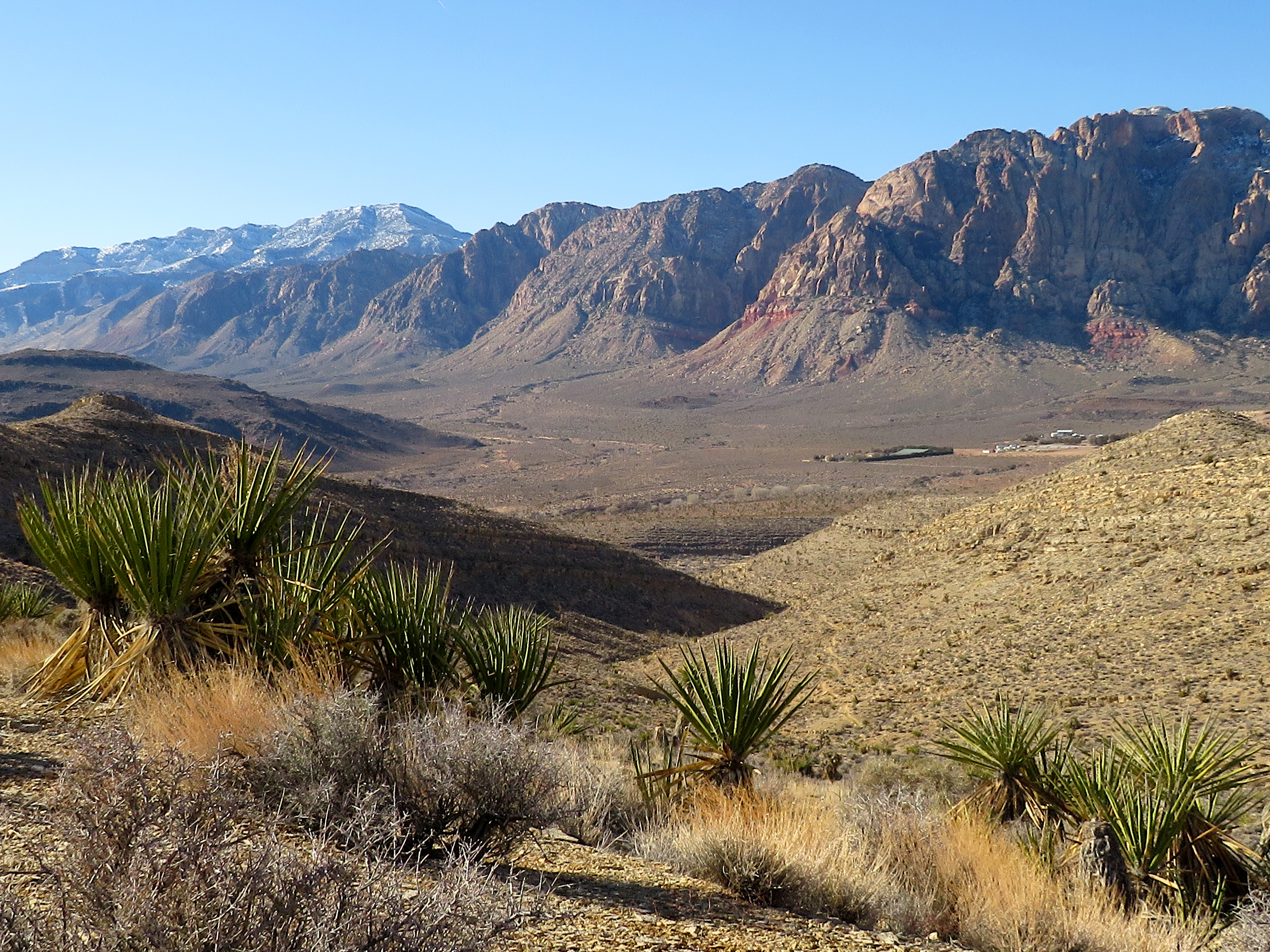
For the first time in a couple of months, seven friends gathered for an "easy" 5 mile hike in the valley on the east side of North Blue Diamond Hill. This area has become quite popular with bikers and local hikers in the recent few years with bike trails snaking their way all over the Red Rock Canyon NCA acreage. Firehouse Hill is a prominent feature of this area, rising between the BLM Fire Station and the cliffs of North Blue Diamond Hill. As an added bonus feature, there is protruding geologic bright yellow sandstone, showing what lies beneath the desert covering. Thus, representative of the Moenkopi Formation, albeit yellow in color. We parked at the trailhead located on the right soon after turning onto Moenkopi Road from SR 159.

Desert Trail along Red Rock Wash

North Blue Diamond Hill from Desert Trail

Dropping into the Yellow Sandstone

Zigzagging on the Bike Path
The Moenkopi Formation is a geological formation that is spread across the U.S. states of New Mexico, northern Arizona, Nevada, southeastern California, eastern Utah and western Colorado. The Moenkopi consists of thinly bedded sandstone, mudstone, and shale, with some limestone in the Capitol Reef area. It has a characteristic deep red color and tends to form slopes and benches. The general deposition setting was sluggish rivers traversing a flat, featureless coastal plain to the sea. The low relief meant that the shoreline moved great distances with changes of sea level or even with the tides. ~ Wikipedia
Bike Path through the Yellow Sandstone

Seven on the Rocks

Is it a Comet? A Plane? A Space Shuttle? No, I think it's Superman!
(Where's Mike?)

Hiking the Vague Trail in the Base Wash
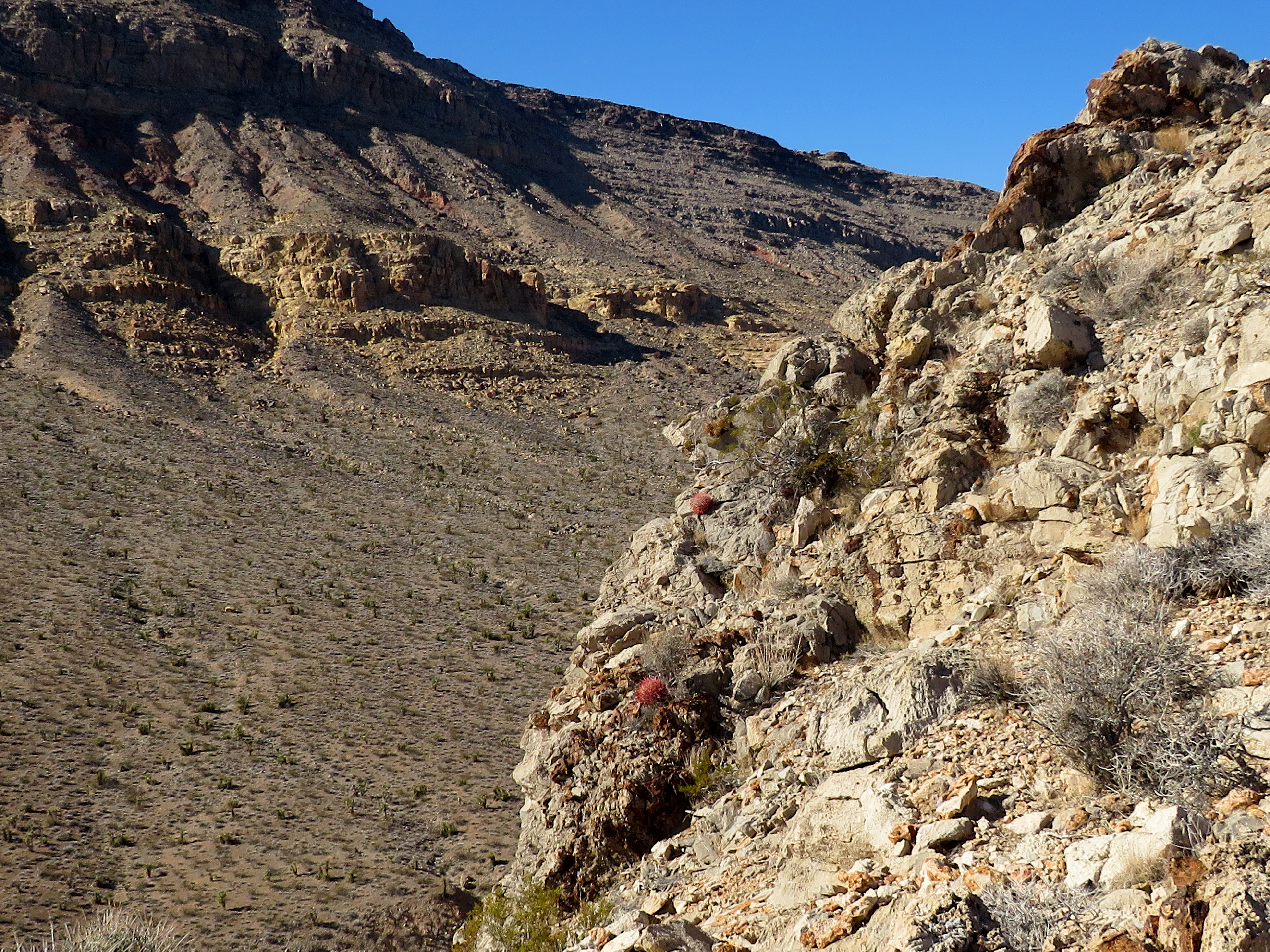
We set off across the desert on a clear bike trail choosing the trail closest to SR 159. Passing a junction turn to the left, we dipped in and out of a small wash. At the next triangle junction, we turned left. This led us up to the top of a ridge trailing from North Blue Diamond Hill. Next, the trail started its fun descent into yellow sandstone, zigzagging back and forth through the rock allowing a bike to pass through. Of course, in the near distance, we saw Firehouse Hill. It looked bigger now that we were so close. Following the bike trail past a few very large boulders, we chose a small wash on the left to connect down to the base wash of the hill. There is a vague trail down and around in the washes. The hike can be done in this wash as well as on its trail.

Firehouse Hill Wash at Base

Crossing the Plateau before Final Climb

Ridge view on Final Climb

Watching a Helicopter from Summit
After circling around the east end of the hill, we climbed up to the ridge to our left. A vague trail awaited there and we climbed up to a plateau area. Here, we could see the secondary peak of Firehouse Hill. Using the far ridge, we followed another trail up to the top and had a break. The descent was a simple clear trail down the northwest ridge with the frigid wind in our face! A cold day for sure! But, so wonderful to see friends and have a good hike!

Stats: 5 miles; 875' gain; 2.75 hours

Summit Break

High Point of Firehouse Hill to Left

Beginning Descent Ridge


Sunday, January 22, 2023

Butterfly Loop - 1/21/23

Goatroper Trail heading Up

Ebb 'n' Flow heading Down

Canyon 5 Wash

Trail above Canyon 5 Wash
The Blue Diamond, NV area is always a good place to go on a Saturday when everything "Red Rock scenic loop" is packed with visitors. The Fearsome Foursome (plus one) parked at the Wheeler Camp Spring Trailhead and crossed SR 159. To find this trailhead from the north, pass Spring Mountain Ranch and Bonnie Springs on the right. Pass the entrance to Oliver Ranch (unsigned) and pass a big brown sign telling us to not feed the burros. Right after the sign, there is a driveway to the right. Be careful of the bumps if you have a low car. If you are coming from south SR 159, pass the main entrance to Blue Diamond (left) and the mine trucking road (right) and the trailhead driveway will be on your left. Much of it is hidden behind bushes and trees.

Trail leading above a deep part of Canyon 5

Transitioning from Canyon 

Zigzagging up to the Goatroper Ridge

Still smiling at Trail Junction
There is a treasure trove of hiking and biking trails to find on both sides of SR 159 here. We chose the north side of the road and made a route track that appears similar to a butterfly ... thus the name. We utilized the trail that proceeded up the canyon and on up to the rim on the west side. There is a thrill hiking above the deep canyon for a couple of minutes then the bike path wiggles itself up the hill to make a left turn toward the ridge in the near distance. This is the Goatroper Trail. There are three long trails along this ridge and beyond; Goatroper, Ebb 'n' Flow and (the unfortunate biker name) Flow Job. Our Butterfly Loop climbs up to the first saddle on the ridge using Goatroper. After a break to enjoy the views, we bushwhacked down the west side to the canyon where Ebb 'n' Flow awaits. This trail crosses the canyon wash and we took a left here. Watch for bikers coming up behind you as this is a one way trail in your direction.

Climbing

Sandstone Bluffs from Saddle

Fearsome Foursome on Goatroper Trail

Needs no Words!
Ebb 'n' Flow circles around the small ridge on the east with loop-de-lous that bikers love. Finally, it drops down into the desert below to cross between the Goatroper above and SR 159 below. The trail ends where the first trail comes out of the wash. We dropped back to the wash and hiked out. All the icy mud from the morning had turned into muddy mud and our shoes slipped and slid. Although somewhat short, this route provides a good workout with nice views on a very busy Saturday at Red Rock Canyon NCA. Check out the butterfly shape of the track below!

Stats: 4.6 miles; 700' gain; 2.75 hours

Rita leading the Pack

Ebb 'n' Flow traversing above Canyon 6

Steep spot on Ebb 'n' Flow