|
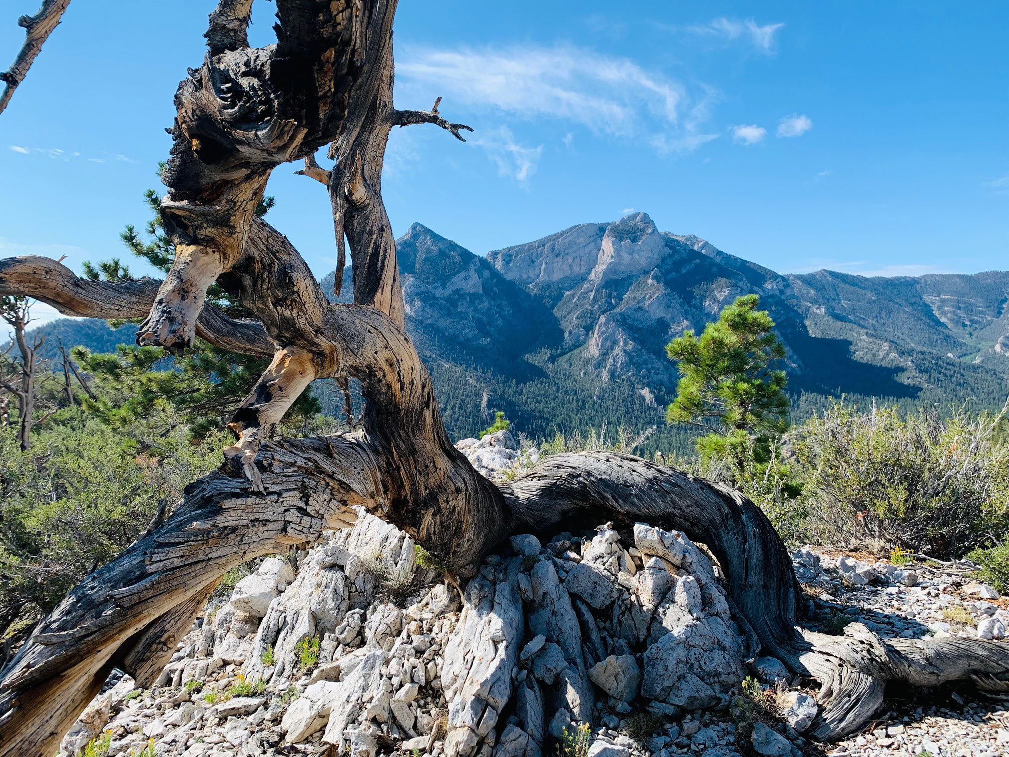
| Foxtail Ridge |
 |
| Foxtail Spring |
 |
| Pinnacle Point on Pioneer Rock Loop |
 |
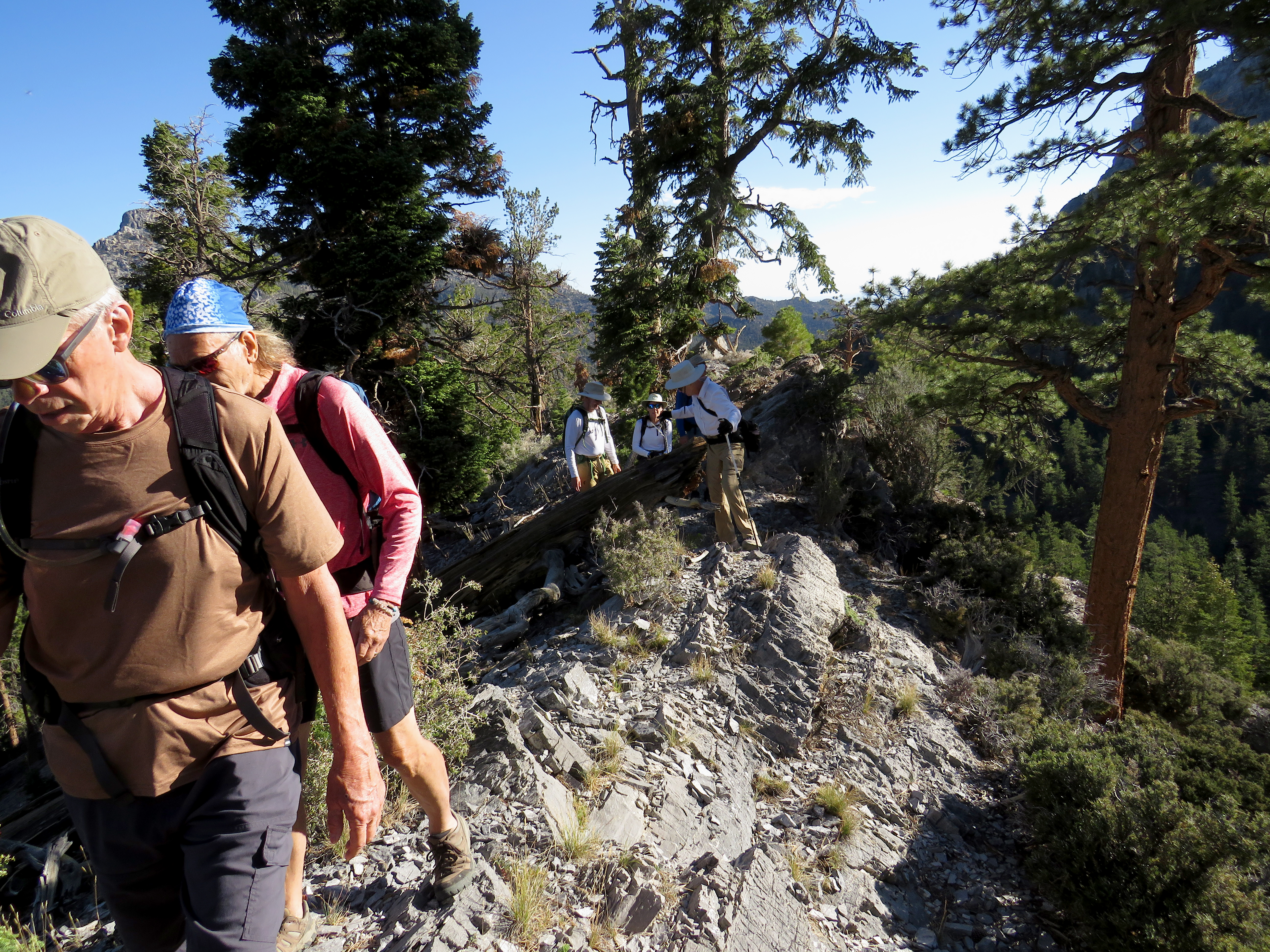
| Seven Strong on the Forest Road Ridge |
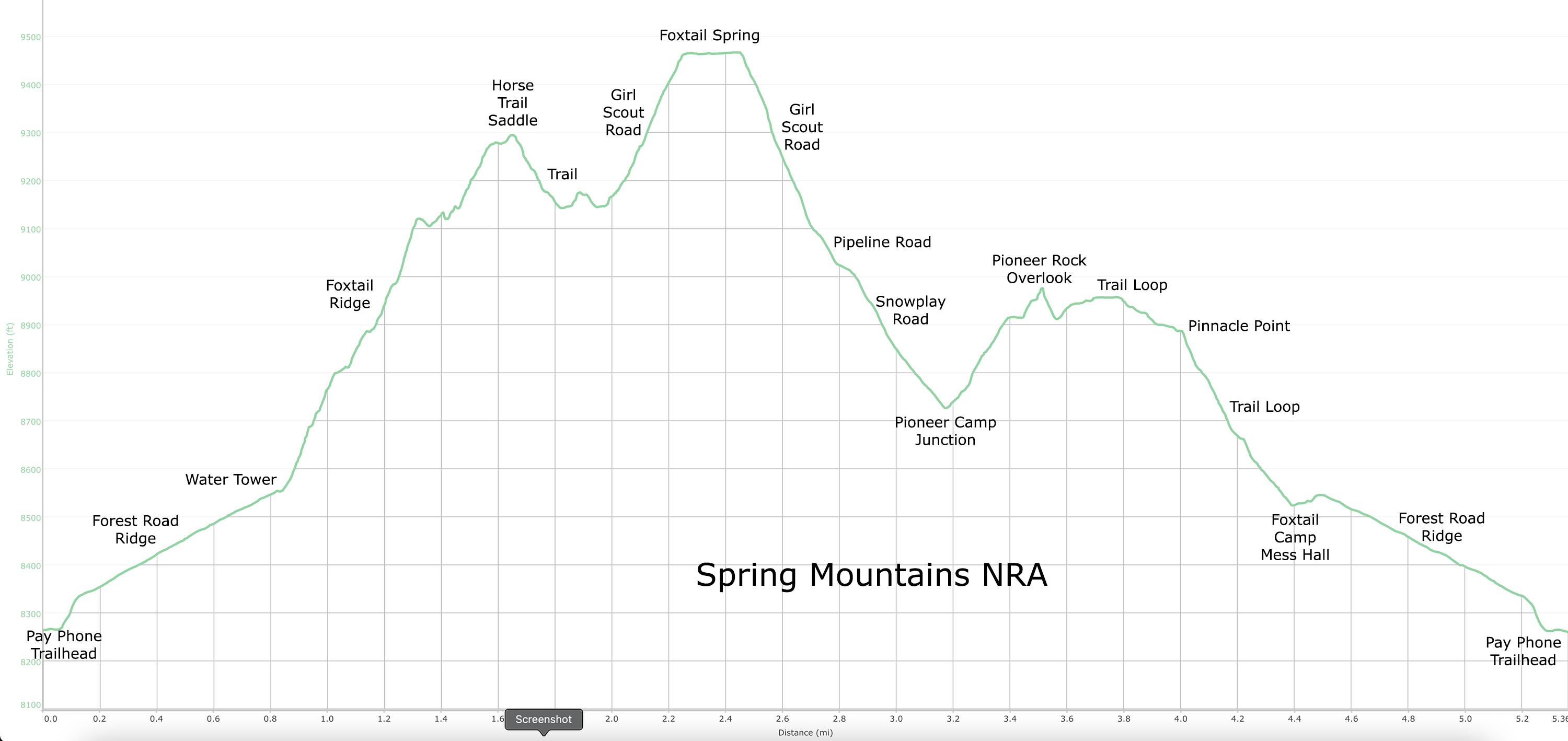
Finally ready for prime time! The Foxtail Grand Loop has been completed with an enhancement of the horse trail leading down from Foxtail Ridge to the Girl Scout Road that parallels the steep rocky pipeline road up to Foxtail Spring. To run a short history of the development of this hike, I will begin by saying the complete loop was made by efforts of Brian D.'s group and our group. Jerry and Cheryl started it all by exploring up the craggy Foxtail Ridge hoping it would be a good alternative up to the North Loop Trail Ridge. In August of 2020, they took our group up the ridge giving us the first glimpse of the abandoned Girl Scout Foxtail Camp and the majestic Pioneer Rock. We climbed the ridge for about 2 miles until the going got pretty messy. But, by then, we were sold on the quality of the views and hike possibilities. We returned down the ridge to the water tank and dropped into Foxtail Camp. At the time, all we knew was that there was a pandemic and that probably the camp was not open. So, we quickly connected with the access road that runs through the Foxtail Picnic Area and hiked out.
 |
| Climbing up to rim of Foxtail Ridge |
 |
| Climbing along rim of Foxtail Ridge |
 |
| Happy Faces on Foxtail Ridge |
 |
| Obstacles on Foxtail Ridge |
About a week later (September 2020), Rita and I decided to explore further into the camp. I had learned that the camp was abandoned and the forest service owned the land. I was especially interested in what appeared to be a trail that led up to the back of Pioneer Rock. To our amazement, we found that the trail continued around the rock on a traverse across Mummy Mountain and down a trailing ridge back to the camp. The trail was absolutely beautiful although some maintenance was due from a fallen tree. We thought it was a fantastic find and showed it to all the hike leaders of the club. Soon, Brian's group got in on the new area. For their first endeavor through the camp, they climbed up the road through Foxtail Camp and past Pioneer Camp where the Pioneer Rock Loop begins. Their objective was to reach the North Loop Ridge from this wash and descend down the craggy Foxtail Ridge. Along the steep climb, they came across Foxtail Spring. (At first, we all called it Pioneer Spring because we didn't know it was officially called Foxtail Spring!) He sent photos of the grotto and in October 2020, our group followed suit and climbed up the steep rocky pipeline road. Pioneer Rock Loop suddenly took a backseat to the new find of the spring grotto. But, it still added to the hike royally!
 |
| Bruce climbs the Ridge |
 |
| Taking a Photo Break |
 |
| Dipping under a Rocky Obstacle on the Ridge |
 |
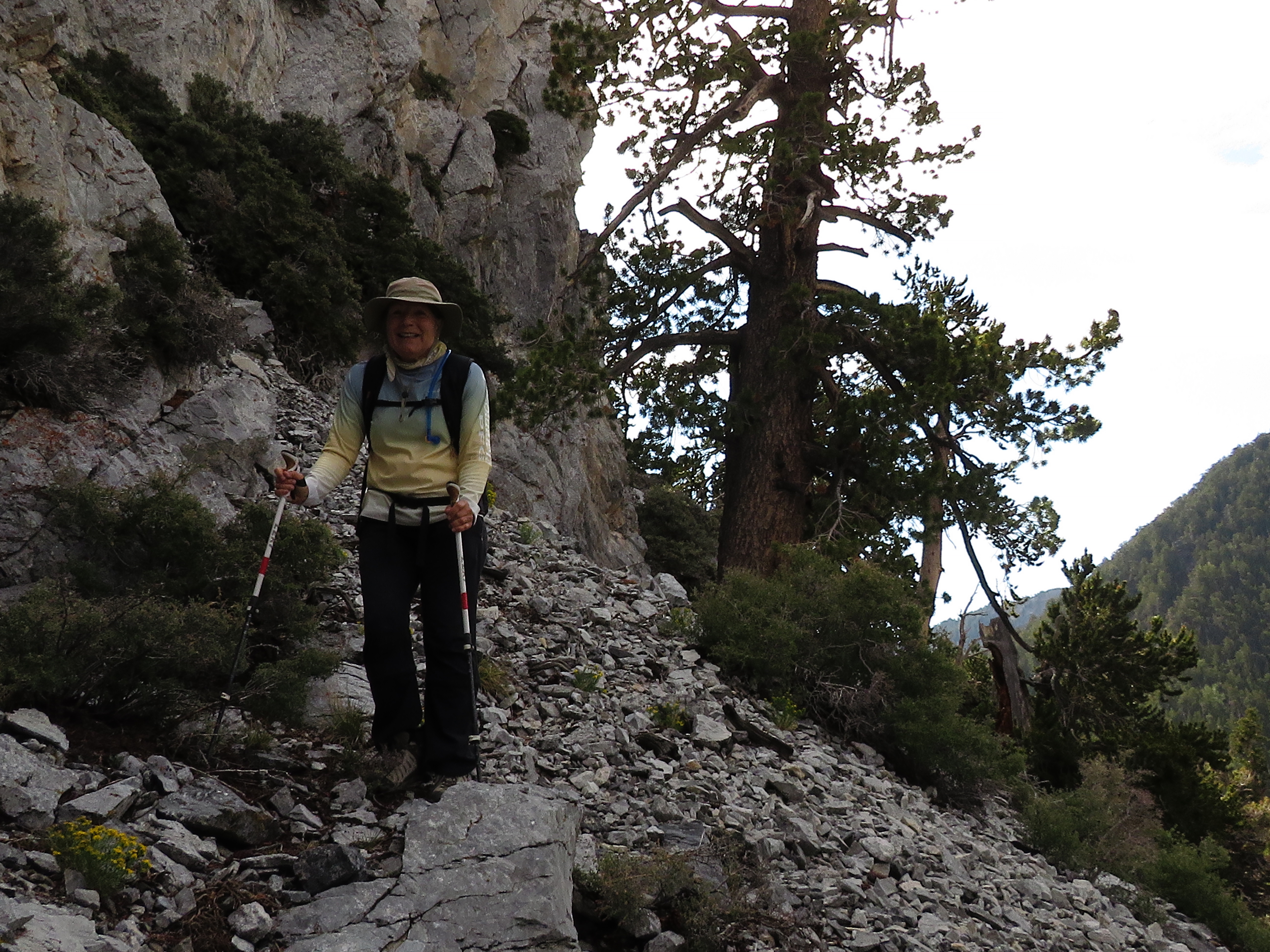
| View from the Horse Trail Saddle |
The grotto continued to amaze us with its different seasons of beauty over the next year. The shooting stars and columbines turned yellow in the fall creating a colorful masterpiece. When we visited in the spring (May 2021), we saw the ice sculpture created by the spring emanating from the cliff side and grotto. This repeated itself the following spring. In September of 2021, we decided to follow Brian's lead and search for a connection between Foxtail Ridge and Foxtail Spring. This connection is complicated by a neighboring wash that appears to have been the victim of an avalanche several years ago. Aspen thickets grow between that wash and about halfway up the ridge and are difficult to wade through. Brian and our group made a couple of attempts to hike down from a particular saddle on the ridge. We located a couple of old horse trails that were stopped by the aspens. On one trip, we made it through the aspens and across the wash and accidentally discovered the Girl Scout Road. Another great find! We assume that this road was constructed and used by the girl scouts to climb up to the spring. It is friendlier than the steep rocky pipeline road that it parallels. We followed it up and came out just below the grotto and ran into Lettie's group who had come up the pipeline road the same day!
 |
| Horse Trail from Ridge to Wash Below |
 |
| Girl Scouts Road up to Foxtail Spring |
 |
| Seven Strong at Foxtail Spring |
 |
| Bee on one of many Shooting Stars at Spring |
In June of 2022, after much research, Brian's group mapped the easiest way between the horse trail coming down from the ridge to the Girl Scout Road. They enhanced the trail with cairns and asked other groups to use the trail in hopes that the path would be made clear. Therefore, we gathered together seven hikers and debuted the Foxtail Grand Loop in July 2022. The following is the story of this hike. We began at the Pay Phone Trailhead and climbed up to the Forest Road Ridge. Along with us were two newbies. What fun! When we reached the water tank, we continued straight and climbed the steep hill up to the rim of Foxtail Ridge. Staying on the rim of the ridge as much as possible, we enjoyed the views of Mummy Mountain and Pioneer Rock across the canyon below to our left. At the second "dip" in the ridge, we stopped the steep climb and found the Horse Trail down. Brian's work is doing its job leading hikers all the way down to cross the avalanched wash and over to the Girl Scout Road. The road was still a workout after the ridge but we finally reached Foxtail Spring and its grotto.
 |
| Second Large Cliff Band above Foxtail Spring |
 |
| Last part of descent on Pipeline Road |
 |
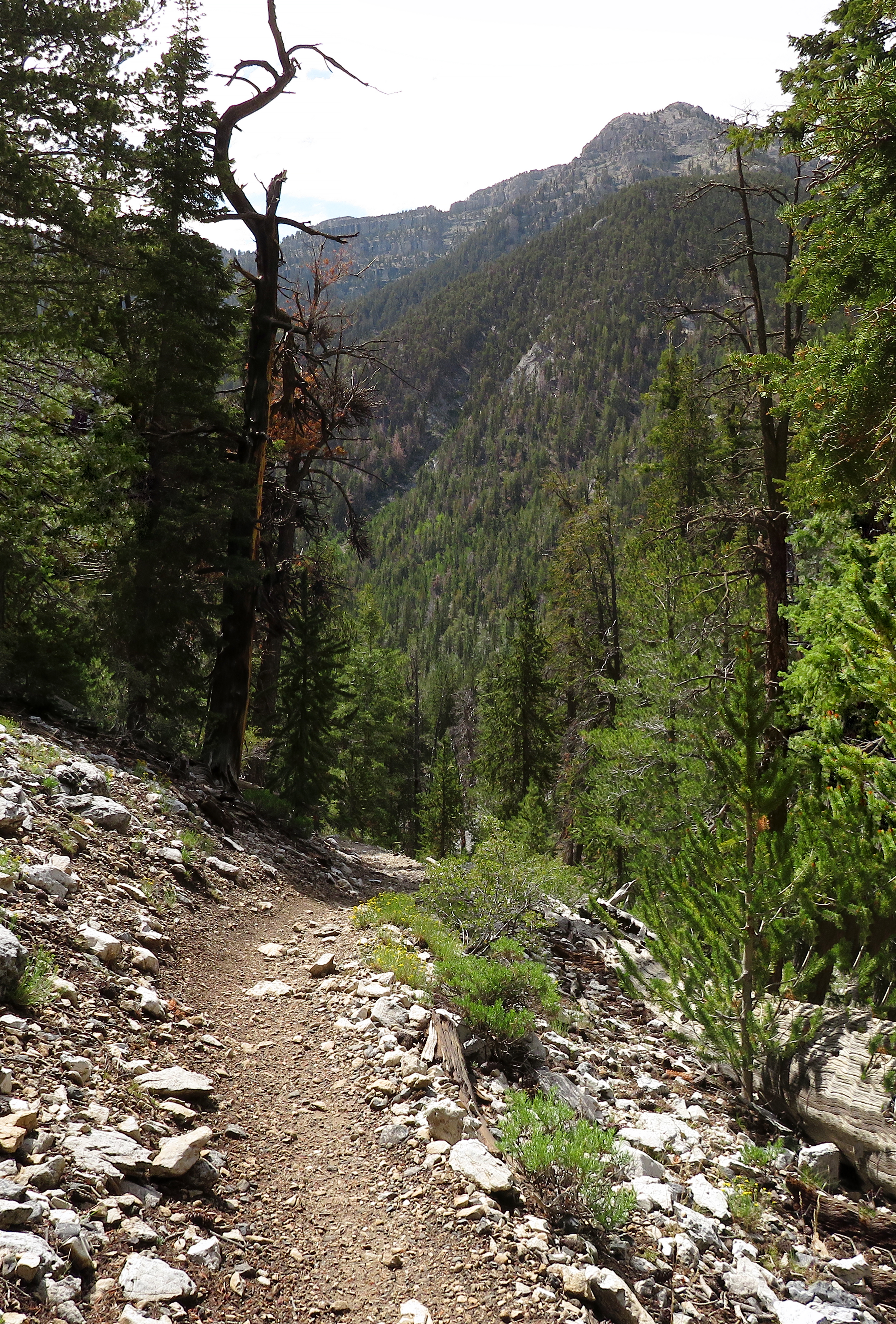
| Pipeline / Snowplay Road |
 |
| Climb up to Pioneer Rock Overlook |
While three of us sat at the grotto, the other four hikers climbed up above and found a gorgeous new area of the wash that has another couple of cliff bands to photograph. After our break, we decided to descend back down the Girl Scout Road instead of the steep rocky pipeline road until we emerged at the latter only one hill up from the trees. Down the last hill and down the more gentle part of the pipeline road through the trees passing the pump station and the aspen lined section. We arrived at the Pioneer Camp junction and turned to the right. More climbing took us up through the camp and up the hill to the saddle behind Pioneer Rock. Five of us climbed up to the overlook outcrop that sits behind Pioneer Rock for a look see. Pioneer Rock is a little bit difficult to get to from behind but you can see it. We returned to the saddle and began the loop trail around the rock and out to Pinnacle Point lying at the top of a trailing ridge. Views are great here but Bruce and Ralph seemed more interested in searching out ways to climb Mummy Mountain from this vantage point! I don't blame them. It does seem rather intriguing.
 |
| Overlooking the back of Pioneer Rock |
 |
| Pioneer Rock Loop traversing side of Mummy Mountain |
 |
| Tree obstacles on Pioneer Rock Loop |
 |
| Pinnacle Point and view of The Sisters Ridge |
We continued down the beautiful trail and returned to Foxtail Camp. Passing the Peace Pole, we climbed the log steps up to the water tank and hiked down the Forest Road Ridge picking up a few bits of trash along the way. In town, the temperatures were reaching 113 degrees! We were very comfortable here in this shaded canyon all day until we came back out to the cars. The Foxtail Grand Loop was well received and is now official! Great day in the mountains!
Stats: 5.4 miles; 1725' gain; 4.25 hours (with explorations at the spring and the rock overlook)
 |
| Peace Pole at Foxtail Camp |
 |
| Climbing camp steps back to Forest Road Ridge |
 |
| South Sister from the Forest Road Ridge |