Wednesday, November 29, 2023

Promised Land (climbing Wall) - 11/29/23


Seven hikers at the Promised Land climbing Wall

Seven club hikers parked at the Willow Spring Picnic Area parking and started up Rocky Gap Road. It was a cold windy start but you can expect that at Willow Springs since the wind comes straight in from the north northwest here. We hiked up the dirt road for about 1/2 a mile then turned to the right onto a faint trail. The trail crosses over shortly to an old two track road and starts up to the left. At the fork, turn right and follow the trail down, up and over the side of a hill above the wash below. Keep following the marked trail until it drops into the wash. Then, basically, follow the trail all the way up through the wash. At the top of the canyon, there is a climbing wall which provides a nice break area at the base with a beautiful view.

Stats: 4.6 miles; 1500' gain; ~3 hours

David leads the pack on the Descent


Tuesday, November 14, 2023

Turtlehead Peak - 11/13/23

Turtlehead Peak trail Approach

Turtlehead Peak view of Cottonwood Valley

Turtlehead Peak backside view of La Madre Peak and Brownstone Canyon

Trail starting up through the Sandstone
Turtlehead Peak is a mainstay of Red Rock Canyon NCA. Twelve years ago, the hike up to the top was filled with slippery scree slopes and trails that went every which way. Trail maintenance has improved the experience a lot but there are still many trails. The improvements include large cairns placed in strategic locations to tell hikers which of the many trails should be taken. ... And, still, mistakes can be made. Mistakes will only add time and/or difficult terrain. It is very difficult to get lost. There were no newbies on the hike this time. We were seven hikers strong. ... And, seven strong hikers. Leaving from the Sandstone Quarry Trailhead located on the Red Rock Scenic Loop, we hiked out to where the Turtlehead Trail hung a left.

View back on Trail

The Seven member Team (add the photographer, Mike)

Up the limestone Trail

Kay Sweeps
There is a sign here. If you go straight, you will be on the Calico Tanks Trail. Our trail climbs a little berm above the Limestone Wash and dumps you back down. After yearly washouts, the trail still takes hikers up the wide gravel wash to another berm on the other side. Up you go. The trail soon connects you to a trailing ridge that leads all the way up to a saddle that is on the Turtlehead Ridge. Between the trail and the peak, there is a deepish wash. With the wash, the rearview of Cottonwood Valley and the Red Rock escarpment and the towering peak, the scene is beautiful and colorful. Even with the overcast skies of this hike, the scenery could not be quelched. (squelched, quashed) We hiked up the trailing ridge at a steady pace lead by Mike who was watching the large cairns. There are also white blushes on rocks to help with navigation. The trail has a strenuous rating due to the difficult footing of scree and scrambling. We stopped only once when we were almost all the way up to the saddle as the trail begins to level out a bit. After a brief separation, we reconvened on the saddle and turned our efforts to the final peak climb. Of course, hikers can make shorter work of the climb by heading straight to the peak but why would you want to. There are too many views you would bypass.

Following the Large Cairns

Taking a small Break

Limestone Outcrops on the Saddle

Mike and a profile of Turtlehead Peak
So, we decided to climb the large circle trail that leads clockwise from the bottom to the top. This is where you will get the views that are in the next two photos. Brownstone Canyon, Gateway Canyon, and Ash Canyon are the prevalent arteries that can be seen from the circular trail. Finally on top, we wandered around taking photos and enjoying our break. We enjoyed the peak all to ourselves. It wasn't until we were half way back to the saddle before we saw anyone else up there. (Unless you count the two morning hikers we passed on our ascent.) Ready to return, we started dropping on one of the many choices of trails. They are all steep and filled with scree. The descent is a slow process. (My doctors have told me not to fall anymore!)

Brownstone Canyon and Damsel Peak

Gateway Canyon from Turtlehead Peak

Group summit Photo

Turtlehead Peak, Calico Hills and
North Blue Diamond Hill
Somehow, I got in the lead again ... that always happens ... and down we went ... slowly. I believe I made one wrong turn as I misread the cairn arrow. But, we were back on track very soon. We passed several other excited hikers. Turtlehead is, in fact, a great hike and the most difficult of the "official" hikes in Red Rock. The views are incomparable. What a great day with great friends!

Stats: ~5 miles; ~2000' gain; ~2.75 hours

Careful descent from the Peak

Descending to the Saddle

Almost to the bottom of the Trailing Ridge - Turtlehead Peak Above


Friday, November 10, 2023

Calico I Scramble Exploratory - 11/9/23

Scrambling at Calico I

Overlook at Calico I

Calico Wash heading toward Calico I

South end of the Calico Hills
Three of us went out to do a hike/scramble in the southern Calico Hills. It was a hike I had done before that we had named the Backdoor Calico Scramble, (https://aroundthebendfriends2.blogspot.com/search?q=Backdoor+Calico+Scramble) a year and a half ago. At that time, I had no problem finding the particular crack that climbs all the way up to the top of the hills. This time, however, it eluded me. (We had a fun time scrambling anyway.)We began from the Calico Basin Road wash trailhead, went through the fence on the right then followed the trail to the left to climb up to the trail that follows along the ridge toward the southern end of the Calico Hills. Using a descent trail, we dropped into the Calico Wash at the bottom and ascended until we found the waterslide as seen five photos below. Last time, we were able to climb up the waterslide into the slot above. This time, we had to use the go around on the left side.

Looking at the Calico Hills

Calico Wash Scramble

Calico Wash

Changing to the Parallel Trail
From there, we continued up until we found the slot climb on the right that is the beginning of that sought after crack climb. Up until this point, at the top of this little slot, we were good. THEN, I got off on the wrong trajectory! And, unfortunately, try as I might, I could not recover! But, it was fun! We were climbing all over the rocks and cliffs ... and a few catclaws (honeysuckle mesquite). There were several other scramblers and rock climbers around and no one knew where it was I was trying to get to! It was that "wave" formation as seen in the second photo of the blog from 2022. Never found it this time! My bad! So, after making a circular route up, around and down, (... found a new ascent/descent route!), we returned to Calico Wash and had a break.

Mike inspects the Rock Pile beneath the Waterslide

Slot Climb

Overlook from Scramble to Wash

Kay stretches Up
Deciding to "just go home," we connected with the trail above us and followed it all the way back to the descent trail that we had used before. Again, we descended to the wash. But, this time, we continued straight at the bottom to follow the trail all the way back out to the cars. For me, this was great! I had never returned to the cars this way before. It was like being on the freeway! No exits! The guys assured me that it was all good. We still did the distance and elevation gain that we had set out to do!

Stats: 4.5 miles; 900' gain; 3.25 hours

Steep Scramble

Needed a Break

Connecting to the Trail on the Other Side


Tuesday, November 7, 2023

Inscription Rock Canyon - 11/05/23

Inscription Rock Canyon (in the shadows)

After this hike, Susan Murphy graciously pointed out that this was not Moonshine Spring that we were heading toward. Our canyon was one canyon north of Black Velvet Canyon. Moonshine Spring is one canyon south of Black Velvet, a place where I thought Mud Spring was located. This is my official correction.    (But, it's still a good story!)     Nevertheless, we were in the vicinity of Inscription Rock. We must have passed right by it and didn't see it near where we took our group photo. (At least a lot of history is located in this area.)

One of our fine Burros

Trail leading past Oliver Ranch

Trail alongside Fence
As we walked along a trenched trail behind Oliver Ranch, Bonnie Springs and Spring Mountain Ranch, I envisioned rough ranch hands and ranch owners alike walking the same trail 200 years ago making regular trips down to a moonshine still somewhere in the dark brushy canyon we were heading toward. I grew up in Georgia where we would hike in the Georgia and North Carolina mountains and, occasionally, come upon a mountain still used to make "white lightning." My Dad would always say, "We don't want to stick around here too long." So my brother and I would scamper on up the trail after my Dad. Bootlegging lived long after the Era of Prohibition ended in those mountains. There, it's best to not drive up a mountain road where people live in small houses and trailers unless you were invited. Let's put it that way. (Revenuers, you know.)

We were together up to this point!

Ralyn, Rita and I stick close to the Wash

Passing the Wilderness sign on Moonshine Spring Canyon Trail

Chuck and Mike survey their side of the Wash
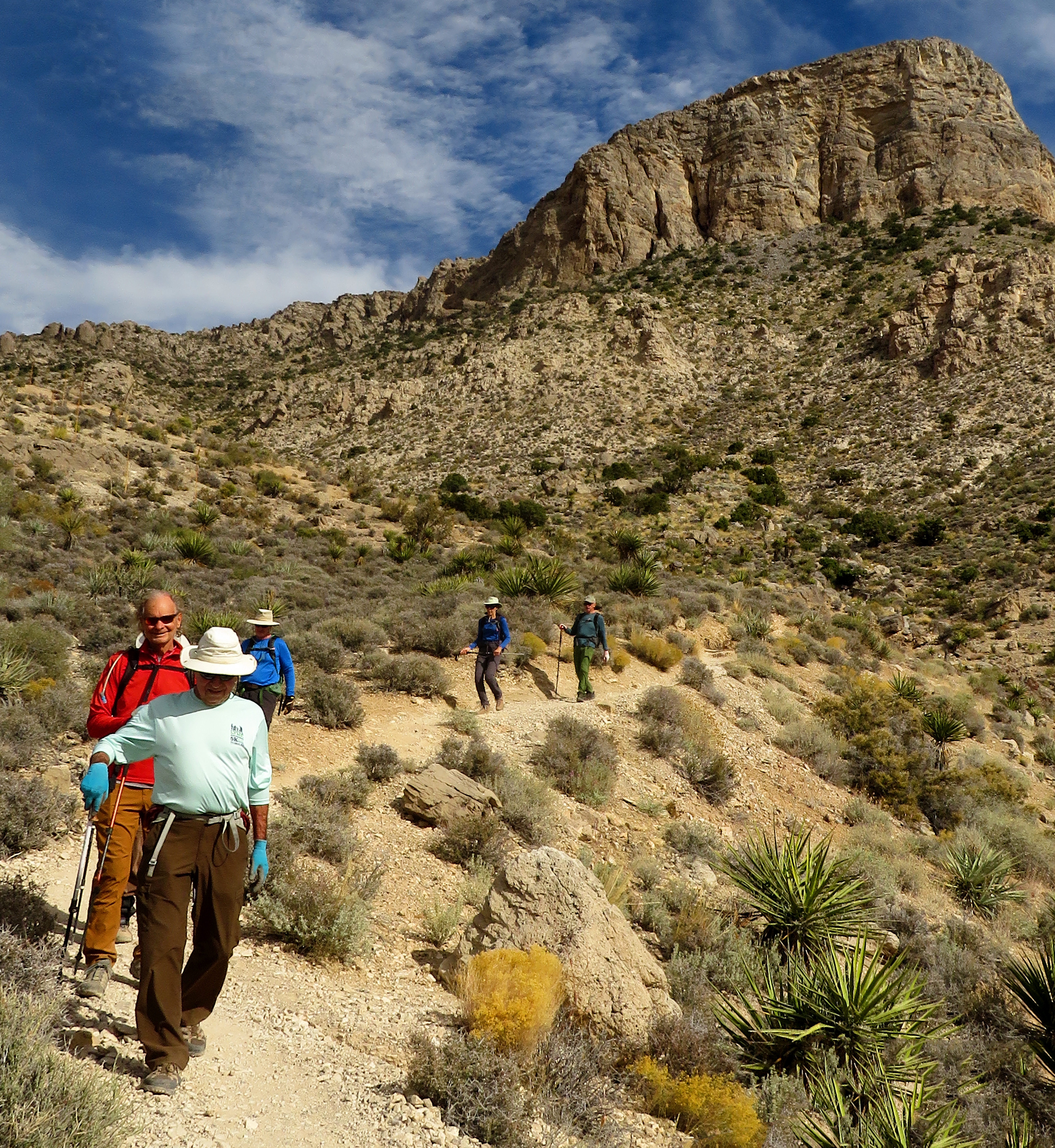
So, when we heard about the Moonshine Spring Canyon in the Red Rock escarpment, we had to pay it a visit. Five of us started out from the Wheeler Camp Spring Trailhead and said "hello" to some bikers who were also getting ready for the day. Dropping down through the fencing, we followed the bike path that is unhindered by barbed wire and turned to the right heading straight toward Oliver Ranch. We took the more comfortable trail above the sandy wash on the left and circled around. Our first burro sighting was in the distance across the Landmine Loop Trail right there. We believed one burro was heavily pregnant. At the back end of Oliver Ranch, we hiked straight along the fencing to the west avoiding bike traffic on the Landmine Loop. Continuing as straight as possible, we began crossing a series of washes that seemed to come together right there. Finding the correct wash to follow was a bit of a challenge but, in the end, it was the northernmost. The trail, however, was not as easily explained.

Just returned from the Spring?

Our view of the guys and a Burro

Moonshine Spring Canyon from our Snack Rock

A spring Somewhere?
On the way out to the canyon, we followed burro trails and better trails staying as close to the wash as possible. (Except for Chuck and Mike who were hiking on the northern side of the wash doing the same thing as they got further and further away.) We came back together where the wash was filled with trees. Maybe there was usually water there for the trees and burros. Ralyn, Rita and I continued on the south side of the wash finding a very good, albeit trenched, trail that matched my GPS red line and began climbing a bit as we neared the canyon. At the apex of the "good" trail, we started out a spur trail that is, at this time, marked with blue or yellow frayed nylon roping. This trail climbed a little more and stopped at the top of a hill where we looked down into the mess that I thought was known as Moonshine Spring Canyon. Perhaps the trail continued from there but, at this point, we were 3 miles in with a nice rock for snacking ... and ... Chuck and Mike were far in the distance on the other side of the wash taking their break. Between us and them, there were 3 or 4 burros who presumably had just returned from the spring ... wherever that is. (I'm sure they know.)

Calico Hills from our High Point

Starting our Return - Photo near Inscription Rock

Desert Garden

Following the correct Trail
After contacting the guys via phone, we decided to all return on the same side of the wash as we each had come. I was determined to find the promised trail and we had a better chance on the return. We did ... find the trail. It is there! So, we followed the trail all the way back to the big wash delta where we fumbled around a little and finally found the trail that goes next to the fence. (BTW, this area shows the trail on the map that swings to the south and comes back. I was trying to avoid the extra mileage by crossing straight through. Thus, the wash delta crossing.) Anyway, we got back just fine, but the boys however, got side-tracked by hiking through Oliver Ranch fencing and up to the road! I guess we all learned something. Love to explore!

Stats: 6.4 miles; 725' gain; 4 hours

P.S. I always welcome corrections. Thanks Susan. I am not an expert but only know what others have told me.

Near the Wash

Crossing the Wash

Almost back to the Fence (Wash Delta)

Chuck indicates where he and Mike ended up! (We are in Red Rock!)