 |
| Artistic Ancient Bristlecone Snag |
 |
| Methuselah Loop |
 |
| Starting Out |
Dendrochronology - the scientific method of dating based on the analysis of patterns of tree rings, also known as growth rings.
Dendrochronology can date the time at which tree rings were formed, in many types of wood, to the exact calendar year. This has three main areas of application: paleoecology, where it is used to determine certain aspects of past ecologies (most prominently climate); archaeology and the history of art and architecture, where it is used to calibrate radiocarbon ages. In some areas of the world, it is possible to date wood back a few thousand ears, or even many thousands. As of 2013, fully anchored chronologies in the northern chronologies in the northern hemisphere extend back 13,900 years. ~ Wikipedia
 |
| The Guys Behind |
This is what seven club members began learning after a long drive to Inyo National Forest, California. We drove up a long winding road called White Mountain Road and arrived at the Schulman Grove, Ancient Bristlecone Forest Visitor Center at the end of the paved portion of the road.
 |
| The Girls in Front |
White Mountain Road is not for the faint of heart. It is narrow and there are many precipitous cliffs on the sides. If you are ready for this kind of adventure, the views are outstanding.
 |
| A Favorite Snag |
 |
| View with Methuselah Trail shown Below |
The Schulman Grove contains what was once thought to be the oldest living organism, the bristlecone Methuselah Tree, at 4,848 years old. In 2012, however, it was de-throned by another bristlecone found in the same area with the age of 5,065 years. Yet another bristlecone was dated at 4,844 years and was cut down in 1964. The forest's "dead wood" shows that it dates back to 11,500 years ago. The trees have adapted to the tough dolomite soil conditions and, therefore, have little competition for growing there. "
The key to the bristlecones' longevity, as they say, is location, location, location!"
 |
| Reading the Interpretive Brochure |
"The harshest growing conditions produce trees that live the longest - they put on tiny amounts of resinous, hard wood and are tough enough to survive the drought conditions that would fatally weaken most other trees."
 |
| White Ridge above Methuselah Grove |
"The 'best' growing conditions - good soil and adequate water - may produce tall, large bristlecone pines but they will not live long enough to become one of the ancients." ~ US Forest Service, Inyo National Forest, Eastern Sierra Interpretive Association
 |
| Bristlecone Forest and View |
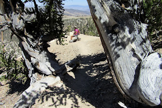 |
| Danuta rests on a Bench |
After buying a few trinkets at the Visitor Center to help support the Eastern Sierra Interpretive Association, we headed out for the 4.5 mile Methuselah Loop trail. We started at around 10,000 feet in elevation so the little hill we hit right away was a little breathy! Rita had picked up the interpretive brochure and we began finding the numbered posts. Each time we found a post, Rita would read the information associated with that number. We all listened and learned quite a bit.
 |
| Various Interesting Snags |
A few of the informational tidbits included: 1) The reason that we should not sit on the roots of Raintree is not because of the root, itself, but because of the loss of dirt around the roots. With every inch of soil lost, there are hundreds of years lost on the tree due to lack of moisture that it can reach.
 |
| Viewing Trees up the Hillside |
2) The bristlecones have a few ways of continuing their survival. New sprouts will grow from old snags using the remaining nutrients. Bark will wrap itself around old wood. Roots spread near or on the surface of the ground to obtain moisture.
 |
| Old Mountain Mahogany Grove |
 |
| Trail through Mahoganys |
3) The various shades of color seen on bristlecones depends on the presence of fungus, the amount of dryness due to age, and whether or not it is rotting.
4) If the tree has bark, it is alive. Otherwise, it is not alive until a sapling has attached itself to the old growth.
Everywhere we looked, we saw ancient bristlecones living, thriving and giving life to new bristlecones on the hill.
 |
| Bristlecone Colors & Textures |
There were nice views from the trail since it seems that the old trees
dig living on steep hillsides. At one point, the trail traveled through a
very old mountain mahogany grove.
 |
| Trail Teaches various Tree-Growing Scenarios |
After the mahogany grove, we came upon an especially interesting snag,
or non-growing bristlecone that is still upright. It is shown in the
first photo.
 |
| Listening to Rita |
 |
| Sculpture after Sculpture |
Traversing the hillside, we next came to what is apparently Methuselah's
home grove. We scanned the hillside looking for a tree that looked
particularly old. Well, they all looked old! The Methuselah Grove is situated around the end of a very rocky dolomite ridge. There are no other kinds of growth in the soil here. The ancient trees have won the survival contest in this area. There was one tree that caught our discerning eye. We named it Medusa! It appeared like that goddess that has snakes coming out of her head! (Find it in a photo down below.) It took a few minutes to walk through this short section. And, no, nobody will tell you which one is Methuselah!
 |
| Another Nice Snag |
After passing around the ridge containing the Methuselah Tree, we
crossed through two large washes with dead wood lying in the ravine.
Bristlecone wood decays at an extremely slow rate.
 |
| Viewing Art from All Angles |
Also on the trail is a cross cut of an old bristlecone tree. Apparently, an inch of the cross cut equals around 300 rings (years).
 |
| Searching for Methuselah in Grove |
 |
| Determined to Live |
The entire trail was like meandering through an art museum with sculptures that grabbed your attention at every turn. We made sure to view the "sculptures" from all available angles. We passed around the corner then began the climb back out. This is where most of the 800 feet of elevation gain is located. Taking our time, we stopped at a few more numbered posts. We were having tons of fun on our moderately strenuous leisurely hike!
 |
| Medusa - (Our Name) |
There were around ten other hikers that we passed during our loop. Most of the tourists probably don't want to undertake the distance of this loop.
 |
| A One Hundred Year Old Sapling |
Slowly, we climbed up the hill. We had acclimated to the 10,000 foot altitude easily.
 |
| Yet Another looking back toward the Methuselah Grove |
 |
| Magical Hike |
Rita continued the informational soliloquy until number 22 was complete. We returned to the Visitor Center for a last quick buy then piled back into our two cars. We escaped falling over any cliffs on the way back down White Mountain Road then drove to Big Pine for dinner and a night's sleep. We stayed at the Big Pine Motel which was very clean and hospitable. And, don't forget to go outside and look at the stars after dark! A fantastic outing!
5 miles; 800 feet elevation gain; 2.5 hours
 |
| Still Living Strong |
 |
| Starting the Climb Out |
 |
| One more Informational Sign |


