Tuesday, March 26, 2013

Gray Cap Loop - 3/26/13

              Top of Gateway Canyon Where the Gray Meets the Red and White

                               Fully Bloomed Mojave Yucca on 5 Stop Hill

 Another large group (seventeen) for Super Tuesday! Today, we set out for a grand partial loop on Gray Cap Peak located to the northeast of Gateway Canyon. Preferring the shortest distance to begin the meat of the hike, we began in the dirt parking lot located deep in Calico Basin. We warmed our lungs by climbing 5 Stop Hill that leads to Krafft Saddle. (The most stops going up the hill that anyone took were about three!)

                                       The Breather at Krafft Saddle

                            Redbud Trees Blooming in Gateway Canyon

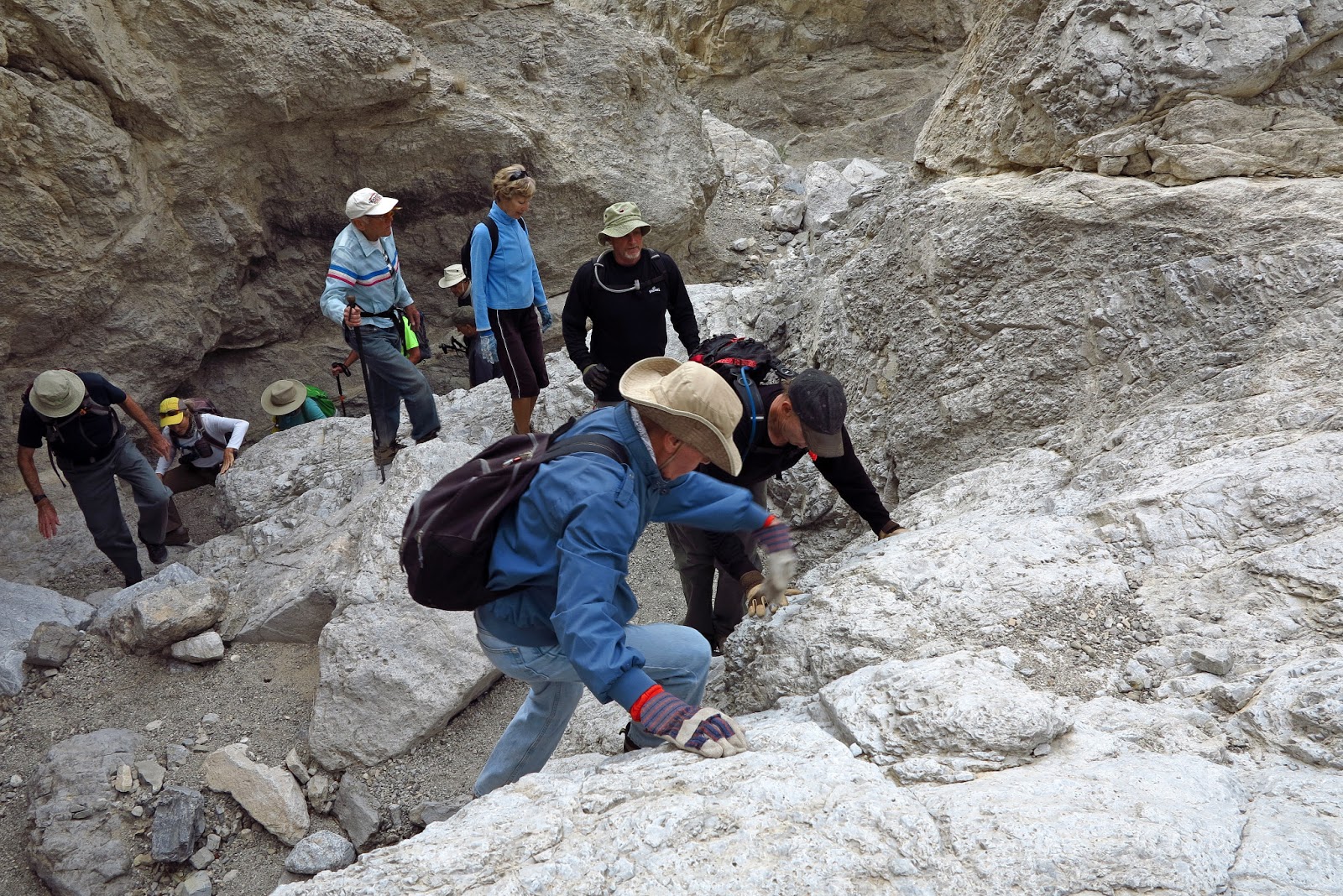
 After a small respite on the saddle, we followed the trail down to Gateway Canyon and hiked up through the gravel. Reaching the Upper Gateway, we began scrambling up the limestone. Many of us knew the obstacles very well, however, there were perhaps around seven hikers who were new to the route. The wash seemed to be deeper than a year ago at many points.

                      Seventeen Hikers Scramble Up Upper Gateway Canyon

                            See the Tree on the Center Ridge? Now GO!

 At the top of Upper Gateway, we took another breather at the red and white sandstone wall. This is a very colorful area. When we said that our next stop was at the top of the wall, the newbies laughed but hesitated not. Up we went stretching our legs and lungs on the steep sandstone. At the top, we noted that the large sunken tank was filled with water (seen below) and we circled around the tank to the left.

                                 The Large Sunken Tank Full of Water

                                       Hiking Around to Last Ascent

 We passed the tank high above on a ledge. No one even flinched at the exposure. Then we began circling around the yellow sandstone peak up to our right. Hugging the wall (as seen above) we had views of Krafft Mountain below. At the end of the traverse, we descended to a sandstone "meadow," if you will. This descent is seen in the photo to the right. The meadow is the last respite before the last ascent. Did we stop? Nope. But we did stop when we reached the famous "picnic table" rock around a third of the way up the last ascent to the peak.

           Beginning the Last Ascent to Gray Cap - Peak Just Above Ridge

We continued our climb and found a slight trail near the top of the sandstone that led over to the limestone layer on which Gray Cap sits. On the peak, the writer's hat immediately blew off her head. No worries. That's what the neck string is for!

                                                    Summit Stuff

 We took our snack break on the leeward side of the peak, wrote in the book and disposed of one tick. When we decided to start the descent, the wind hit us hard as we dropped down the limestone on the windward side. Upon reaching the sandstone, we were a bit flummoxed! Where were the cairns? Not sure what happened but a traverse to the east began in search of a way down. It soon became apparent that a new descent route had been born!

                                Beginning of Descent With Peak Above

                                Traversing Over to the New Descent Route

 We found our descent route in a red sandstone canyon that seemed to lead straight down to Gateway Canyon. The photo to the right shows our view of the next hour of scrambling. In the top right of the photo, you can see the trail leading up to Krafft Saddle on the other side of Gateway. So, we knew that if we could find our way down, we would be in good position to complete the hike. Sure enough, with just a few twists and turns, we found our way to the canyon below at a point very near our ascent path to Krafft Saddle. From there, it was a piece of cake back to the cars ....

The whole 5 mile loop hike was completed in four hours. It had a total of 2208 feet of elevation gain.

                                  The New Descent Ends With a Drop

                                  Last Squeeze Before Gateway Canyon


                                         All Gray Cap Descent Routes

                                   All Gray Cap Routes from 5 Stop Hill

Monday, March 25, 2013

Oak Creek - 3/25/13

                                                       Oak Creek

                                                Oak Creek Canyon

 Twenty-four hikers participated in the 5.5 mile out and back hike along Oak Creek up to the mouth of the large bouldered Oak Creek Canyon. With only 633 feet of total elevation gain, the hike was considered moderate in rating but it did move along and we finished the whole hike in around three hours. Starting at the gravel parking lot found at the end of the Red Rock Canyon Scenic Loop, we followed a horse trail that led towards Potato Knoll at the base of Wilson Peak.

 It's nice to hike through the desert at this time of year since it gives us a chance to check on our native plants. This year, all the cacti and yuccas appear to be very plump and "happy." Many of the flowering plants are beginning to bloom and this includes the joshua trees and mojave yuccas, plants that do not bloom every year.


                                              Joshua Tree Bloom

                            Snack Break at Mouth of Oak Creek Canyon

                       Mojave Yucca Bloom (T-L), Joshua Tree Bud (T-R),
               Joshua Tree Blooms (B-L) and Cactus Wren Nest in Cholla (B-R)

 After finding our way from trail junction to trail junction while crossing Oak Creek three times (one time it was dry), we arrived at the mouth of Oak Creek Canyon where further hiking would require scrambling over large boulders. Today's hike was only a trail hike so we stopped here for a snack break. As we sat on the rocks, we watched three rock climbers above us who were scaling the side of Rainbow Peak.


 The trail we hiked, today, took us right by Potato Knoll as seen in the foreground of the photo to the right. Millions of years ago, this knoll was formed from a landslide that fell off of Wilson Peak. The indentation that the slide left can be seen on the face of Wilson Peak in the photo.

The return to the cars went quickly and the weather, we noted, was warming up again after a few days of cold wind. It is an early spring this year. Yea!

                            Return Trip with Calico Hills in Background

                    Blooming Joshua Tree in Front of Red Rock Escarpment


Tuesday, March 19, 2013

Juniper Peak - 3/19/13

                                    Calico Hills From Juniper Peak

                                  Juniper Peak Within the Escarpment

 Today's Super Tuesday Hike attracted seventeen hikers to Juniper Peak. Juniper Peak is a minor peak along the Red Rock Canyon NCA escarpment that reigns between Mescalito Peak and Rainbow Peak. The best way to approach this peak begins at the Pine Creek trailhead off of the scenic loop. We made quick time down into Pine Creek Canyon and, after a small break at the old Wilson foundation, crossed Pine Creek and found the Arnight Trail.

 The Arnight Trail leads over to the base of Juniper Canyon where another trail turns off to the right and heads up to the gaping bouldered wash above. As we took another short break, we noticed Rainbow Wall and Gunsight Notch at the top of the canyon. Rainbow Wall is an extremely large concave wall that is famous for very advanced rock climbers. A photo of the wall is seen seven photos down.

                              Big Boulder Scramble of Juniper Canyon

       Upon reaching the sandstone slab, hikers check out the upcoming route.

 We followed the trail until it dropped into the wash that was covered completely with very large boulders. Climbing the wash takes a lot of upper body strength as the hand holds became just as important as the foot holds. The route, at this time, is heavily cairned which is useful at the many twists and turns. Nearing the top, we were obliged to climb a slippery dirt trail section which eventually led to a steep rock fall.

 At the top of the rock fall, we reached the well known sandstone slab. The slab is very steep but sloped enough to allow climbing in proper hiking footwear. We were now headed up to the north with our focus on a "turtle gargoyle" peeking out just above the ridge. There was a lot of sandstone between us and that turtle so up, up and away we went toward a left turn at the ridge.

                                Halfway Up the Slab to the Left Turn

                                         Waiting For the Stragglers

 The views in this section of the hike were becoming incredible with Rainbow Wall to the south and the North Blue Diamond Hills to the east. We were reaching the top of Juniper Canyon's source. Still on the sandstone, we occasionally followed a trail that led through the bushes. Cairns still ruled the route.

 Just as we were reaching the aforementioned left turn, Mike pointed out that there is an easy way to go up and around the exposed passage that was before us. Exhausted and spent, the writer couldn't care less how "exposed" the twenty foot climb was if it was a short cut to the left turn!!! No, really. It wasn't bad. Compared to Bridge Mountain ... it was about the same and not nearly as dangerous.

                             Mike Demonstrates the Steep Exposed Route

                                Looking Out from the Wall Trail Ascent

So, we got past the slope in question and turned left where we reached a trail that climbed up next to the peak's wall. There was also a dirt trail that led parallel away from the wall but the comfort that the wall provided was worth the high steps. At the top of the wall, there was more climbing. Around the corner, across the ledge (seen to the left), and up through the rabbit hole we scrambled. (That rabbit hole was a doozy!)

 When we had a moment to breathe, there were views of Bridge Mountain, Bridge Point Peak, and Mescalito Peak to our right. This view is in the photo to the right. When the writer arrived, finally, on the peak, the party was well underway. Time for a well deserved snack break while we enjoyed the colorful views and very cool breeze.

                              Seventeen AtBF Hikers on Juniper Peak

                                  Bridge Point Peak from Juniper Peak

 We signed into the log book and took the summit photo above. The photo to the left shows our view when we looked down. That's Oak Creek trailhead that you see in the top of the picture. We were getting a little too cold so we started down through the rabbit hole or the optional slide over the cliff as seen below!

 We were very careful as we made our way down the wall trail, down the "exposed" rock (done easily on the booty), and down the sandstone slab portion. The group regathered at the top of the rock fall and slowly pulled themselves up to tackle the rock fall, steep dirt trail and then the very large boulders.

                           Tom Descending the Steep Exposed Sandstone

                                Susan Negotiating the Sandstone Slab

 By the time we reached the mouth of Juniper Canyon, some of us were pretty tired. All that scrambling down exhausts your arms, legs and stomach muscles. We were all happy to see the trail that would lead us back to the cars. For the return hike, we chose the trail that leads directly down from the Arnight Trail to the Fire Ecology Trail. This is slightly shorter and we were soon making the long climb up the hill on the Pine Creek Trail to the cars.

The hike was a little over five miles after accounting for GPS bounces and there was an elevation gain and loss of 2349 feet. It took us less than five hours for the entire out and back hike.

                  Taking a Final Break at the Bottom of Juniper Canyon

                                              The Sandstone Slab