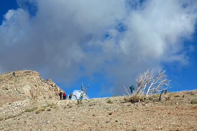
Sixteen hikers arrived on this windy and cold Christmas Eve morning to do the Bird Spring Range hike. We drove up Highway 160 through a light rain shower ready to get wet on the hike. Three and a half hours later, the clouds were a lot less threatening, there was a light dusting of snow on nearby Mt. Potosi and not a single drop of rain touched our jackets. We did, however, encounter some moderate winds.
View from the Badger Pass Trail
The hike began at the Badger Pass trailhead found south of the escarpment and Cottonwood Valley. We brought along the geologist in residence of Red Rock Canyon NCA, Nick Saines (seen to the left), who was interested in becoming more familiar with the Bird Spring Range area. In turn, he gave us some very interesting information on the fossils we found on the ridge.
Atop the First Peak of the Bird Spring Range
Without a notepad, the writer remembers a few facts that she hopes isn't too "layman speak":
1) The fossils found here and in the North Blue Diamond Hills are from the Permian Kaibab Era, 275 million years ago.
2) This era was ended by the extinction of 90% of life on Earth due to a rise in temperature of only 10 degrees Centigrade.
3) These fossils were made from the death of this life at this time.
4) The next era, the Triassic, began the evolution of life all over again ... dinosaurs, etc. ... so there was a long period of time when there was no life to leave fossils. That's why so much of the Earth does not contain apparent fossils.
Las Vegas Strip from the Cliff Area of the Bird Spring Range
It is all very fascinating and Nick can say it so much better. He leads interpretive hikes for Red Rock Canyon and the schedule for these can be found on their website.
Today, after climbing up to the top of the small Bird Spring Range where the fossils are located, we spent a lot of time looking around for some of the great fossils in the rock and chert. (Chert being the black rock seen adhering to the conglomerate and limestone in this area.)
The photo to the left shows a brachiopod fossil in chert.
It was so nice to have someone with us that had so many answers to our endless questions about what we were encountering up on the ridge. Thanks, Nick.
At the end of the first portion of the ridge, we carefully hiked down to the dirt road that approaches this site.
Coming Down off of the Cliff Area Ridge
From here, we hiked down the road toward Deadhorse Trail, the trail that would return us to our cars. This is a pretty trail that leads next to the drainage where there is much greenery in the form of junipers and joshua trees. In the photo to the left, Don showed us where there is an ancient agave roasting pit next to the trail.
Today's hike was 6 miles with 1300 feet of gross elevation gain. Merry Christmas everyone!
Deadhorse Trail


No comments:
Post a Comment