 |
| Red Barrel Cactus on North Blue Diamond Hill |
 |
| Calico Hills and La Madre Mountain Range from North Blue Diamond Hill |
Another absolutely gorgeous day! There were eleven hikers on this foray into the North Blue Diamond Hills. Today, the route began at the Cowboy Trails trailhead parking lot on Highway 159 in the Red Rock Canyon NCA and headed into Cave Canyon. We passed the upper corral for the trail rides, then dropped into the mouth of the canyons beyond. Cave Canyon is the left fork canyon. We immediately began a steep climb into Cave Canyon along the right wall.
 |
| Hiking Up Between the Walls of Cave Canyon |
 |
| Upper Cave Canyon |
At the top of the climb, we came to a large indentation in the wall on
the right. It is covered with graffiti at this time. From here, we
crossed the wash and continued up passing more graffiti. A formidable dry fall of around fifteen feet had to be climbed and, with perseverance, we managed. Next, we came to one of the caves up on the left side of the canyon. All the newbies, and there were several, took a look in the cave. After this cave, the graffiti subsided.
 |
| Exposure for the Day! |
With the business of the dry fall and cave out of the way, we continued up between the walls. There was some brush but, for the most part, a trail found its way around it. Sometimes, the trail led up on the side of the wash. Mostly, the trail went right up through the middle of the wash. There were a lot of small scrambles and we noted several different fossils inlaid in the limestone rock under our feet. This area of the world used to be under the sea in Precambrian times. Usually, the fossils we find are sea bed creatures.
 |
| Reaching the Final Dry Fall Alcove |
 |
| Climbing Out of the Alcove |
We came to a fork in the canyon and chose the left fork again. This led us for another half mile or so to a large dry fall alcove. There are a few ways to climb the rock and everyone chose their way. After getting to the top here, we continued easily a little further up the canyon until we junctioned with a bike trail. We turned left on the trail and hiked over to the Boneshaker Hill junction while enjoying a vast view of the Red Rock Canyon escarpment.
 |
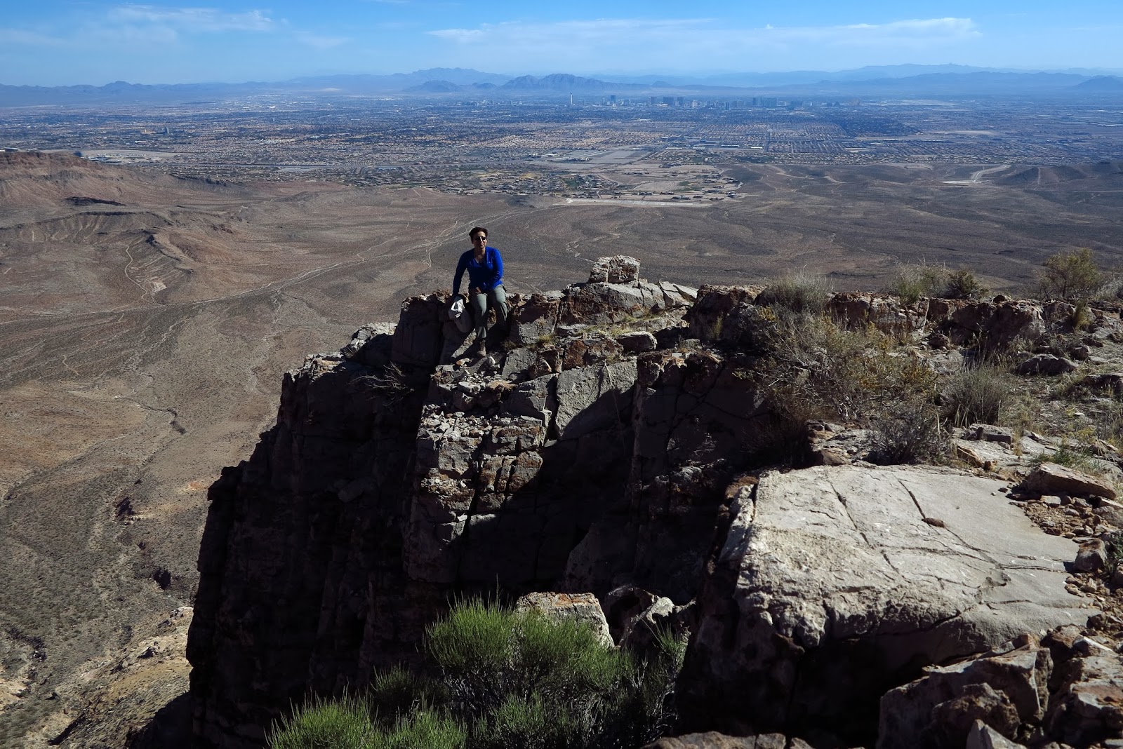
| Approaching the Las Vegas Overlook Break Area |
The Boneshaker Hill route is marked by a large cairn and a faded sign. However, we hairpinned to the right and climbed the hill up past the relay station and solar panels. At the top of the climb, we came to the "new" Las Vegas overlook where we had our mid-morning break. The air over the Las Vegas Strip was fairly clear today and we took several photos of ourselves standing on the cliff in the foreground.
 |
| Tall Cairn |
After our break, we began hiking around the rim trail to the north. This is a beautiful trail from which you can see all of Las Vegas and much of Red Rock Canyon and the La Madre mountain range. After our long ascent before the break, we had a nice long descent in front of us. Our first point of interest was the "old" Las Vegas overlook. We didn't stop long for the view and continued down and up the trail to the next ridge.
 |
| Trail to the Old Las Vegas Overlook |
At the next ridge, we had a choice. We could have taken a 90 degree turn to the right and climbed up and over the ridge to get to the Muffins. Instead, we took a soft right onto a small trail that led around that ridge. To our left was Skull Canyon. The small trail took us gently around to a trail above the Muffins sharing vast views of the escarpment and Calico Hills with us. We junctioned with the main trail right at the edge of the rim again.
 |
| Hiking the Small Trail to the Muffins |
 |
| The Muffins and Calico Hills |
The main trail took us down to the Muffins where we enjoyed another overlook of a beautiful day. There were a few hikers who had never been to the Muffins before and they had a short exploration of the area. The rest of the hikers could "smell the barn" and off they went down the trail! When everyone was ready to continue, the remaining hikers started down.
 |
| Hiking Down from the Muffins |
The sunlight was in a perfect position for the hike down. It showed off the hill and the colors across the way to their best. We enjoyed our descent, made our way across the base of the hills to the stables, then reached the cars.
7.5 miles; 1600 feet of elevation gain; 4.25 hours
 |
| Fabulous View While Hiking Down |
 |
| The End |


No comments:
Post a Comment