 |
| Manly Beacon & Red Cathedral from Old Road Trail |
 |
| Red Cathedral from Trail Below |
 |
| Telescope Peak from Badlands |
It was a long day. It was a warm day. BUT, it was an exotically gorgeous day! Eight club hikers drove to Death Valley National Park making good time and arrived at Zabriskie Point at the Furnace Creek badlands area just as the sunrise photogs were coming down off of the newly refurbished overlook. We hiked up to the overlook and got a few photos in ourselves. The morning was cool and a nice breeze blew over us intermittently.
 |
| The Team at the Refurbished Overlook |
Two hikers got to the trailhead as we were coming down from the overlook. They would do the overlook at the end of the hike. All together now, we prepared for our hike down into the badlands.
 |
| Close Up of Manly Beacon from Overlook |
The trail started to the right of the billboard trail signs and was marked by lined up rocks. It took us to a small saddle in which a square cut was made. This was obviously an old abandoned road, probably this end of the old Golden Canyon Road.
 |
| Old Road Saddle Trailhead |
The old road wiggled down the hill until it junctioned with the wide Gower Gulch wash. There is a trail sign here that points out the hiker's choice of turning right to continue on the trail or heading down Gower Gulch. We chose to go down the wash that stayed wide and coarsely cut with recent flood waters. The scenery around us consisted of badlands made with brown and white colors. The badlands were basically hardened sand of various rock and minerals.
 |
| Hiking Down Gower Gulch |
The wash was easy to hike. There was a trail running through it which was mostly void of loose rock.
 |
| Morning Shadows |
The morning sun still provided shade and we stayed cool. Maria set the pace and it was a fast one!
 |
| Gower Gulch Color |
We junctioned with the Golden / Gower Loop trail near one of the mines
found to the left just off the wash. We were about halfway down to the bottom. Next, we passed a large white mountain of sand that was colored with "chocolate sprinkles." The scenery was very exotic and we couldn't help talking about what it reminded us of. As we neared the narrows, the canyon gulch became more narrow.
 |
| Gower Gulch & "Chocolate Covered Ice Cream Cone" |
At this point, we saw the second mine located up to the right. There is now a well-worn trail up to see it. We ventured up there and saw that it is gated. There is also another trail that leads up to the high ridge in this area. We did not explore this trail.
 |
| Gower Gulch Narrows |
Entering the narrows of the gulch, the walls became colorful in darker hues. The wash winded left and right.
 |
| Mild Scrambling in Gower Gulch |
Finally, we reached the mild to moderate scrambling portion as the gulch dropped down to its end. Being careful of the smooth worn side rocks, we planted our hands and dropped our legs to lower and lower levels. When the group wound around the last bend, oohs and ahhs ensued! The gulch ended with a 40' to 50' dry fall drop. The dry Manly Lake bed lay before us and the Panamint Mountain Range rose beyond that.
 |
| Nearing the Dry Fall |
The trail turned to the right where we were obliged to hike along the edge of the wash below. Thus, we began the trail across the foothills toward the Golden Canyon trailhead parking.
 |
| Mouth of Gower Gulch at Manly Lake |
Peering off down the valley (left), we saw Telescope Peak (11,043 ft) and the edge of Badwater. During our foothills crossing, we reached the low point of our hike at minus 177 feet in elevation. Therefore, the rise of the nearby peak was very impressive.
 |
| Crossing the Foothills between Gower Gulch and Golden Canyon |
We stopped at the Golden Canyon trailhead using the shade for a snack and the pit toilet for ... well, you know ... while hiking tourists passed by us. We were still very comfortable but the total ascent lay before us. The light breeze became more and more appreciated. Refreshed, we started up the gold colored canyon passing by the remnants of the old road's pavement. Golden Canyon appears different from Gower Gulch as the geology is more striking and the wash is less ... well, washed! The gentle climb led us by interesting rock formations. Some formations jutted out from the walls while others rose high above. Narrow shade remained on the east side. Soon, we could see the red wall of the Red Cathedral at the far end of the canyon coming into view.
 |
| Golden Canyon Ascent |
Along the entire hike, there was very little vegetation. Two hikers wondered how one little scrub bush survived high up on the rock wall. Maybe mile long roots!
 |
| Golden Canyon with Red Cathedral Beyond |
The white veins in the walls interested us. Was it the borax that was and is still mined here? There were also veins of green and orange. And, all of this used to be under the sea!
 |
| Studying the Canyon Wall |
The group gathered at the next junction sign and we decided to continue
up the spur trail to get a photo opportunity of the Red Cathedral. The spur trail was an increase in slope and the heat in the small canyon could be felt. Nevertheless, the views all around from this vantage were worth the effort. Up to our right rose Manly Beacon, a tall pointy mountain of sandstone. Ahead of us was the Red Catherdral wall. And, to our left, we saw ripples of gold and browns in the hills.
 |
| Red Cathedral from Spur Trail |
We got our photos then, on the return to the junction, we got fantastic views out to Telescope Peak as seen in the third photo of this entry.
 |
| Climbing Up to the Base of Manly Beacon |
We turned at the signed junction and began the most difficult climb of the morning up to the base of Manly Beacon. This part of the trail is very dramatic.
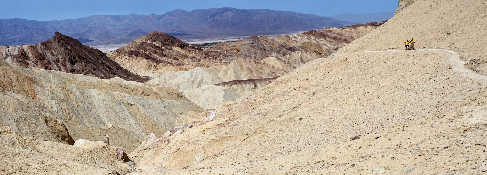 |
| Panorama from Base of Manly Beacon |
We passed a few people going down here and saw that it was ill-advised. There is a little exposure and the sandy trail is slippery when descending. The climb made us aware of the increasing heat but, slowly, all 8 of us crested out at the contouring base trail then descended on the other side. The trail then leads across another ridge and down into a fork of Gower Gulch. Here is where there is another junction choice.
 |
| Descent from Manly Beacon Contour |
If you continue down the wash, you will flow into the same wash in which we descended earlier.
 |
| Manly Beacon from Gower Gulch Side |
We chose to turn left here. This is the continuance of the old road. It takes the hike up onto the ridge above.
 |
| Trail Well-Marked with Old Signs |
We zigzagged a little (as seen in the photo to the left) then made a steep climb up to the most beautiful view of the entire hike! To our left, we could see Manly Beacon and the top of the Red Cathedral with colorful ripples in the hills below (as seen in the first photo of this entry). This is definitely where the sunrise photos should be taken! ... Next time!
 |
| View Back Down Gower Gulch |
Looking back, we could see where Gower Gulch drops down to the valley. Up ahead, our hikers were going along the ridge.
 |
| Team on the Ridge Above |
The last hiker was dealing with heat issues but still made it up to the ridge in due time. The temperatures were probably in the mid-80's by now.
 |
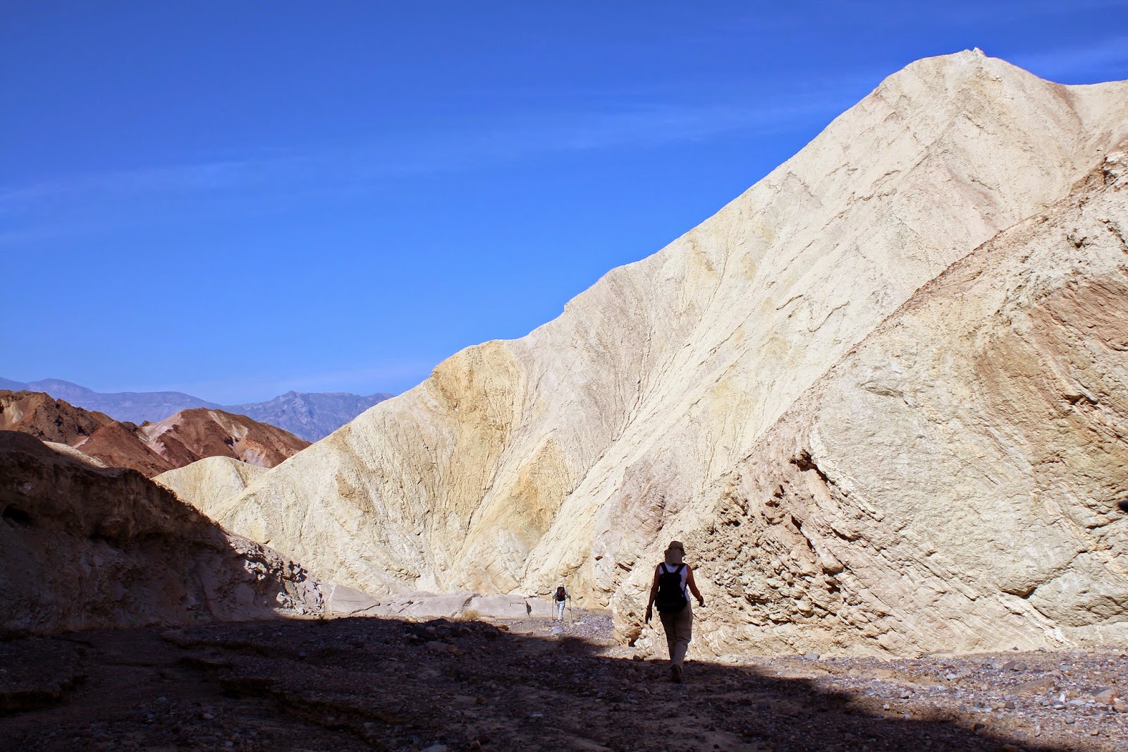
| Fantastic View from Old Road Trail |
This last leg of the hike was probably the writer's favorite! Although the contour trail around Manly Beacon is very impressive, the ridge view from the old road is amazing ... eh, incredible ... um, fantastic? Where is the word? We hiked on down to the first junction we had come to that morning and turned left to climb the old road trail back up to the squared out saddle. All accounted for. Definitely worth the drive! Very good and different hike.
8 miles; 1750 feet elevation gain; 3.75 hours
 |
| Old Road Trail |
 |
| Gower Gulch at Junction with Old Road |
 |
| Returning to Old Road Saddle |
After the hike, four of the hikers drove down to the Furnace Creek restaurant for lunch where we parked next to Old Dinah. We did a "once through" in the souvenier shop then got back in the car for a drive up to Dante's View. Spring flowers were still blooming in these upper elevations. The undeniably impressive view from the top made us glad we took the time, then we headed on home. From Red Rock Casino to Red Rock Casino, it was about a 10 hour day.
 |
| "Dinah, won't you blow your horn?" |
 |
| Dante's View (Hazy Skies) |
 |
| Late Flowers on Dante's View Road |
 |
| Hike Graph without initial Climb to Overlook |
 |
| Hike Graph with Overlook Climb at End |


No comments:
Post a Comment