 |
| Sunrise at Zabriskie Point on a Nicer Day in January 2016 |
 |
| Gower Gulch |
 |
| The Early Morning Trip in a Nutshell |
 |
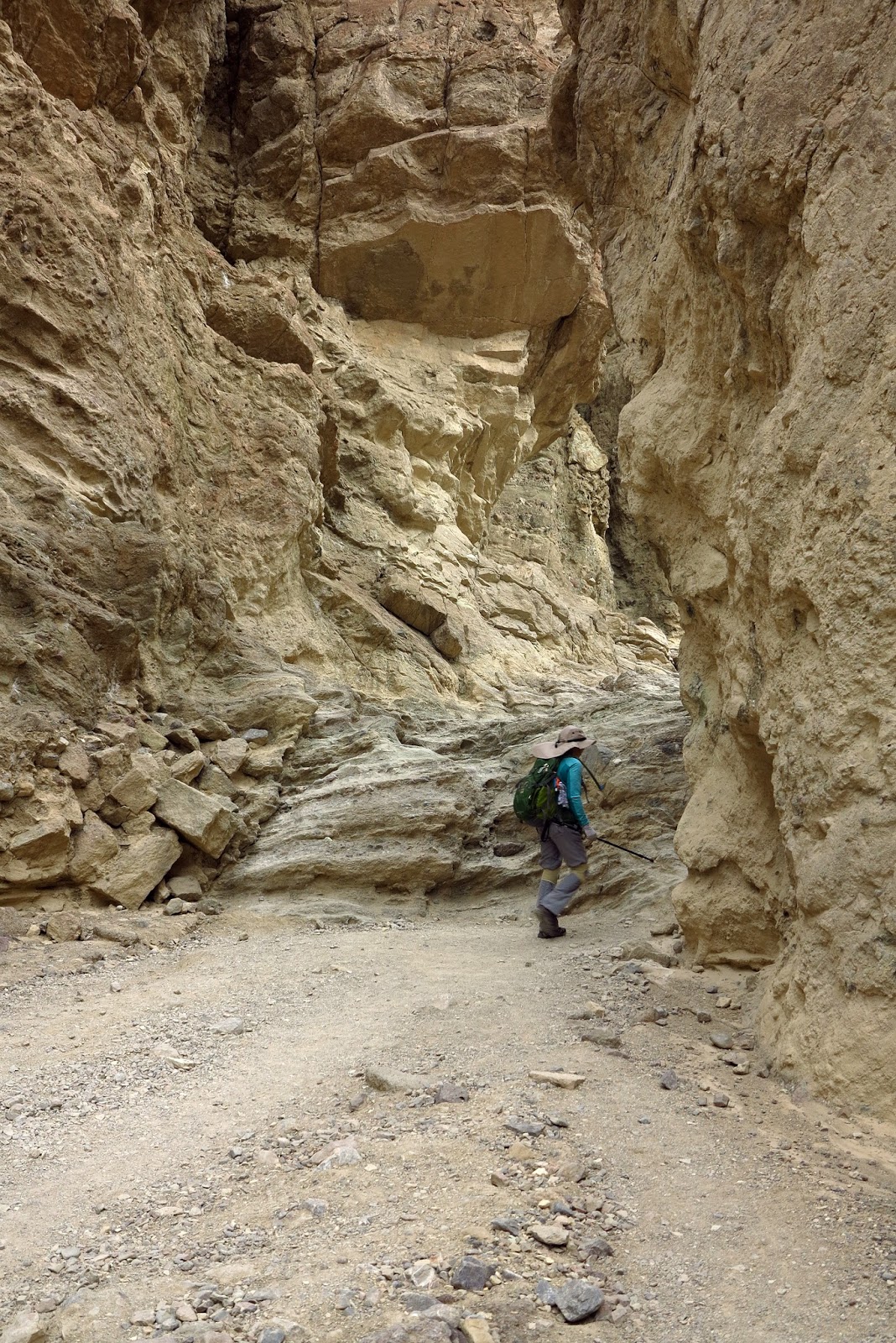
| Starting Up Golden Canyon |
The Death Valley National Park 2016 excursion has ended and it is now time to make the report. This first entry covers the first day of the trip. Gusty wind started about half way into our first hike but, the up side, the temperatures stayed pleasantly coolish. While twelve hikers decided to do the short version of the Golden Canyon / Gower Gulch hike, the remaining twenty-one went for the entire loop. After a two hour road trip for many of us, we met at the Golden Canyon Trailhead found two miles from Highway 190 on Badwater Road.
 |
| Vicki turns the Corner |
There was a ranger led hike going on at the same time so the parking lot was filled to overflow. Many cars were parked down on Badwater Road.
 |
| The Strenuous Group lags behind the Moderate Group |
We started up Golden Canyon and quickly passed the ranger's group while she expounded on the canyon's geology.
 |
| Hike through the Fossilized Sand Dunes (Badlands) |
 |
| Manly Beacon rises above the Horizon |
This is a beautiful canyon with many colors in the brown and yellow categories. The overcast skies actually brought out the colors very well even though the photos don't reflect it! It wasn't quite as dismal as these photos appear. Both groups reached the trail junction at the same time where the route turns to the right for Manly Beacon and straight for Red Cathedral. Here, we separated. The strenuous group headed up for the base of Red Cathedral. The front of the line was already climbing up into the hills before the end of the line arrived!
 |
| Climbing Up toward Red Cathedral |
The back half of the line chose to climb up through the nice interesting slot canyon instead. Then the group got together again to climb up to the overlook.
 |
| Laszlo's Perspective from the Top |
At this point, there wasn't much of a trail. Our hikers were just stretching their legs having fun on the interesting terrain.
 |
| Some Hikers used the Cool Slot |
 |
| Up to the Overlook |
We passed a few purple phacelia flowers in this rocky area. We had noted on the way into the park that the best of this year's "Superbloom" was on its very last legs. Here and there, we saw patches of flowers that still looked good but the recent rain and today's wind wasn't good for their looks. Most of the hikers played around up above while the rest of us stayed just below the overlook wondering where the scramblers would come down. A few came down the way they went up and we all began descending the slot again.
 |
| Phacelia |
As we descended back to the trail junction, the explorers joined us from various points up on our right.
 |
| Returning from Red Cathedral |
We gathered at the junction then headed up to the base of Manly Beacon, a prominent point rising above us.
 |
| Leaving Trail Junction to Manly Beacon |
 |
| Climbing to the Base of Manly Beacon |
As we tackled the hill, the wind began to blow pretty hard. It was fine until we reached the somewhat exposed part of the trail. Here, the wind gusts started trying to blow us off the trail. Well, the hike
was labeled strenuous! We handled it expertly and no one lost their hat! The views from this section are beautiful and we still got a few photos. Then, we dropped down the other side into a badlands wash that leads over to Gower Gulch.
 |
| Hanging on to the Trail in Heavy Wind Gusts |
Out of the wind temporarily, we passed a group of younger folks and turned onto a trail to the left at a signed junction.
 |
| Out of the Wind until the Next Trail Junction |
The sign said Zabriskie Point. This is actually a very old road turned trail that was used during the mining times.
 |
| Climbing Up to the Manly Beacon Overlook |
 |
| In the Wind Again - But What a View! |
The old road took us up on top of the badlands ridges and offered a fantastic view of Manly Beacon and Red Cathedral from the other side. We were, again, in high winds and didn't waste time getting our photos and views before we were able to drop down off of the ridge into the top of Gower Gulch. In a previous hike, we had started and ended our hike at Zabriskie Point which was now right over our head. Today, the hike's turnaround point was here which eliminated the "string" of the "balloon" route.
 |
| Another Windy View |
We gathered at the Gower Gulch junction and took a hard right into the wide wash.
 |
| Gathering at the Gower Gulch Junction |
Our first order of business was to find a place out of the wind for a snack. Shortly, we found a decent place for many hikers to sit and we took our break.
 |
| Taking Our Break out of the Wind |
 |
| Hiking down Gower Gulch |
Afterwards, we started down the wash which appeared to have been recently flooded. It was completely dry but the mud covered the wide area making a somewhat flat surface. As we descended, we followed footsteps in the dry mud from bare human feet! What a hike that must have been! The hills surrounding us were colorful and we passed three old mines evidenced by rock walls and/or holes in the side of the hills. Eventually, the wide canyon began to narrow.
 |
| Gower Gulch Narrows |
We headed into the Gower Gulch narrows and began scrambling. The first scrambling was mild, then it became moderate in nature.
 |
| Color in the Narrows |
The colors of the walls were a striking red and green. Then we dropped down the highest of the scrambles which has become steeper over the recent years.
 |
| The Longest Scramble of the Gulch |
 |
| Maria heads for the Finish |
The group gathered one last time just before exiting the gulch at the high dry waterfall. Here, the trail turns to the right and follows along the wall for a bit. After that, it is a beautiful traverse along the mountains to the right back to the Golden Canyon Trailhead. The wind was still blowing but the gusts of the initial storm system had mostly passed. We opted to give everyone a choice in handling the windy afternoon the way they wanted and we dispersed. It was a great start to the weekend.
7 miles; 1200 feet elevation gain; 3.5 hours
 |
| The Rest of the Group Follows |
The shorter version of the hike (Golden Canyon / Gower Gulch) ended at just over 4 miles, 1000 feet of elevation gain and around 2.5 hours. (They didn't even take a snack break!)
 |
| Gower Gulch Trail above Resulting Wash |
 |
| Traversing back to Golden Canyon Trailhead |
Windy Afternoon Sites
 |
| Wind Rustling Up the Sand Dunes |
 |
| Fast Moving Flowers |
 |
| One Mile into Badwater Basin |
The windy afternoon saw the AtBF club members all over the park. Some went to the Visitor Center and Borax Museum. Some went up to a cold and windy Dante's View. Some hiked way out into the Badwater Basin. And, some went all the way out to Stovepipe Wells where the sand dunes were being blown all over the valley! There were still a few good places for flowers but the wind made it difficult to get flower photos even though there were a lot of tourists out there trying. Eventually, we all made it back to the Longstreet Inn & Casino to check in.
 |
| A Few Interesting Flowers off Beatty Cut-Off Road |
 |
| Devil's Cornfield |
 |
| Today's Elevation Graph |
 |
| Today's Hike Eliminated the "Balloon String" |


No comments:
Post a Comment