 |
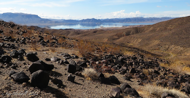
| Lake Mead (Boulder Beach) from Black Mesa |
 |
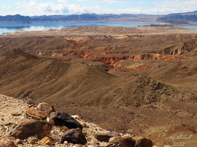
| Fortification Hill (L), Lake Mead (C), Black Mesa Ascent Ridge (R) from Sheep Trail Ridge |
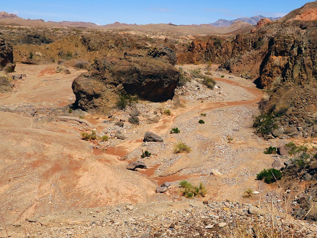 |
| Rock Island in Boxcar Cove Wash |
 |
| Tortoise Fence |
The Tenacious Trio took advantage of the cool day to return to Northshore Road at Lake Mead NRA. We parked at the large trailhead parking on the right off of Callville Bay Road. To our right, Black Mesa rose gallantly.
This long low hill has a flattish top and is composed of basaltic andesite that was erupted from fissures and cinder cones between 10.6 and 8.5 million years ago. The basaltic andesite overlies weaker rocks (siltstone). The weak rocks on the flanks of the mesa erode readily, but the resistant caprock serves a a barrier that slows the erosional process. The softer, underlying rocks are light-colored, but the entire mesa - sides and all - appear dark because the slopes are mantled by a layer of dark rock talus cascading down from the weathering cap rock. Geologic Tours in the Las Vegas Area (Expanded Edition with GPS Coordinates), Nevada Bureau of Mines and Geology Special Publication 16, University of Nevada, Reno, Mackay School of Earth Sciences, 2008, Bear Printing, Sparks, NV; pages 64, 66.
 |
| Kissing Callville Bay Road in first Mile |
 |
| Descending into Wash |
 |
| Passing Colorful Hills next to Wash |
 |
| Hiking the Sheep Trail Ridge |
To reach the ascent ridge on the southeast corner of the mesa from our position on the northeast corner, we chose a series of three washes and a couple of ridges. These made a route that led close to Callville Bay Road and up to a ridge and down into the next wash, thereby avoiding the jumble of hills and steep washes laying closer to the base of the mesa. When possible, we found sheep trails. These trail are easier to see on Google Earth than they were to see at ground level but they are very helpful. Finally, in the last wash before our ascent, we found two almost complete skeletons of female bighorns that were recently preyed upon by a mountain lion. Scat was located next to the skull of one. Soon, we were climbing another trail up a long ridge to gain the first level of Black Mesa. |
| Reaching the Peak Cairn - Callville Bay Marina in Background |
 |
| View of Lake Mead from Peak Cairn |
 |
| All Three Benchmarks were Located |
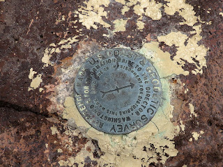 |
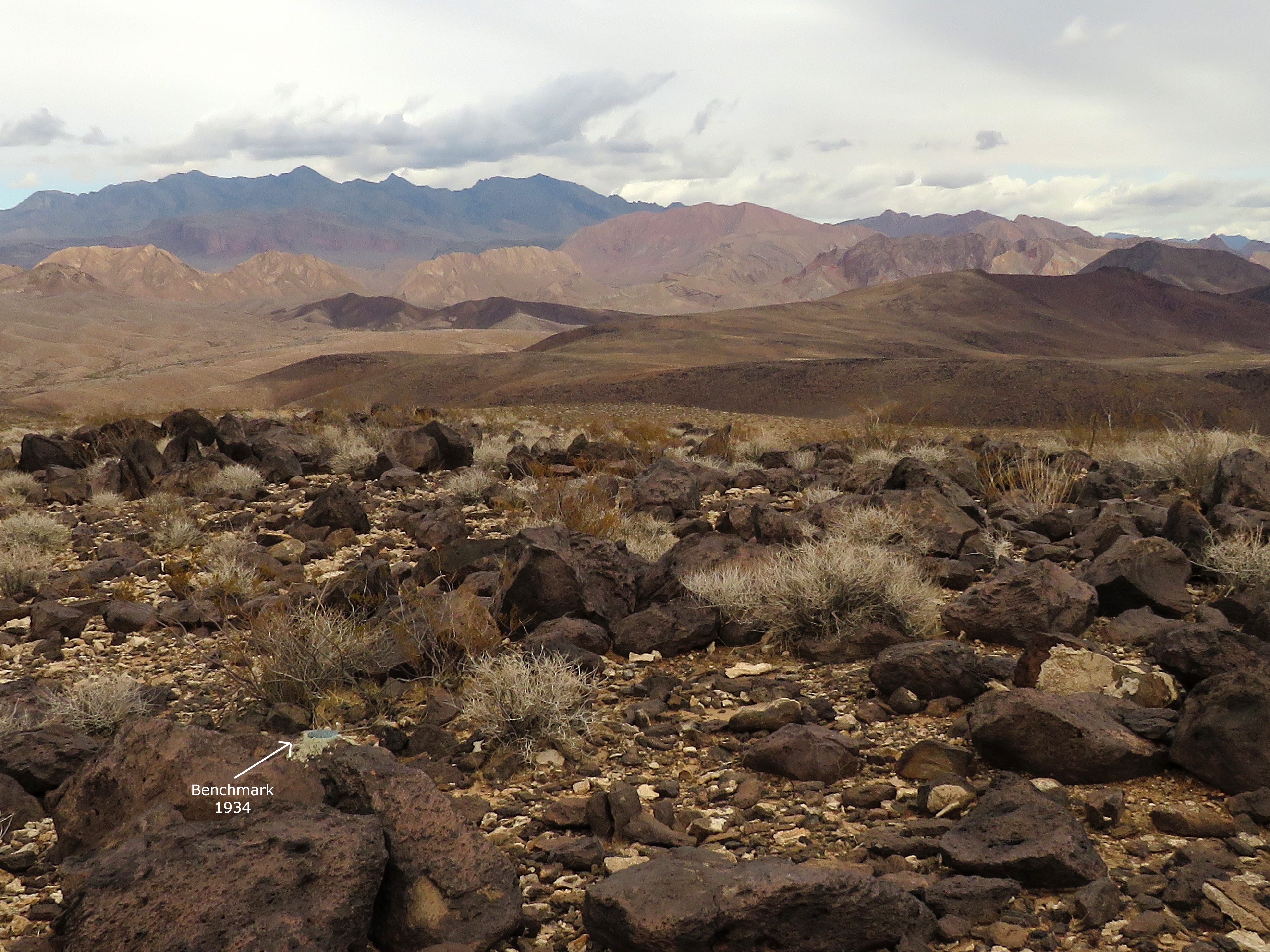
| 1934 Black Mesa Benchmark |
There was a small cairn on the west embankment rock and I knew were closing in on the left jog to the car so I had faith that this cairn was a true indication where we should turn. We turned and hiked straight to the old car; a nondescript rusted truck whose bed was once lined with some kind of fake fur. Hmm. Interesting. After a few photos, we beelined toward the northeast to hit the wide wash again. The wash curved around the north end of Black Mesa and led us all the way back to below the trailhead. During this time, we made our group photo in the wash since we had forgotten to make this fun feature when we were at the peak. Next, we found a small trail leading up the spine of a small fork ridge and hiked right out of the wash and over to our car.
 |
| The Challenging Descent |
 |
| View up to Mesa from Descent |
 |
| Crossing Ridges to get down to Boxcar Cove Wash - Lava Butte in Distance |
This was our first time to hike Black Mesa. We used previous routes and tracks from Chuck Hawkins and Brian Dodd. My first impressions are that the views were gorgeous and our ascent route (used by Brian as a descent route) is the best. The old car is interesting but we had no idea what kind it was. The peak cairn needs a register log book. And, finally, bighorn sheep are not safe from mountain lions here! But, all in all, it was definitely a great adventure!
Stats: 5.5 miles; 1200' gain; 4.5 hours


2 comments:
Great blog again. It looked hard!
Rita
Hmmm. It kind of was!
K
Post a Comment