 |
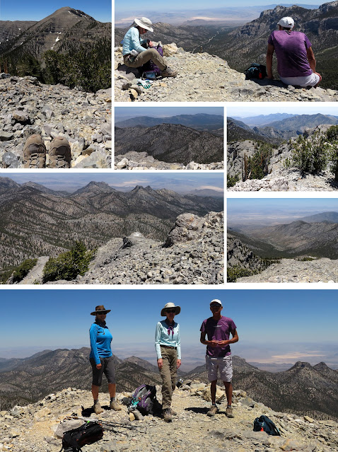
| Southeast View from Lee Peak |
 |
| Southeast end of Lee Peak |
 |
| Charleston Peak from North Loop Cliff Area |
 |
| Trail Canyon Saddle (2.15 miles up) |
Last week, Rita and I conquered Griffith Peak (11,064'), the fourth highest peak in the Spring Mountains NRA. This week, Ralyn, Bob, Mike and I ventured up on the North Loop ridge to summit Lee Peak, the third highest peak behind Mummy Mountain (#2 at 11,533') and Charleston Peak (#1 at 11,916'). The big question was, "Were we ready for the altitude of Lee Peak which reigns in at an official 11,332'. It is still only mid-June and, although we have climbed to the 10,000' elevation 7 times this spring, it may have been a bit early for us to delve into the 11,000 foot zone so deeply. At any rate, we started from the Trail Canyon Trailhead early in the morning and made the saddle in this summer's record time for us. Again, the morning sun on this trail was enchanting. It was going to be a cool day with temperatures reaching to only 73 degrees at the trailhead and 67 degrees on the ridge. Also, the wind had finally taken a break from flailing us for the last three days. This is perfect weather for a major climb. On this hike, we would climb into the center of the Spring Mountains; into the midst of their peaks and cliffs made from Paleozoic limestone and dolomite which were formed around 100 to 90 million years ago. When hiking to the upper elevations of these mountains just outside of Las Vegas, Nevada, you can't help your mind from wondering about the way these mountains were made. On every peak, there are seabed fossils in the limestone. The magnificent fault(s) making the cliffs rise up would have made quite the fast motion video. I sure would like to see that video.
 |
| Ralyn at Cave Springs Trough (2.4 miles up) |
 |
| Resting at Mummy Tree Log (3.5 miles up) |
 |
Scree Slope below North Loop Trail
|
 |
| Mike at the 4 mile Overlook |
We turned up to the left on the North Loop Trail and proceeded to Cave Spring. Our rest breaks were short but taken at every half mile or so. Slow and steady was our mantra. After Cave Spring, the four of us started spreading out but we waited at each stop for the last one to catch up. The next two stops were Mummy Junction and the 4 Mile Overlook. Mike brought up the rear citing an altitude headache. At Big Falls Overlook, he decided to turn back. The three of us forged on. The most challenging part of the climb was now behind us and the next mile would be scenery, scenery, scenery. Both Charleston Peak and Lee Peak were on display. Well, Lee Peak's trailing east end ridge rises in front of the peak itself.
Stats: 12.5 miles; 3725' gain; 7.5 hours


No comments:
Post a Comment