 |
| Turtlehead Peak trail Approach |
 |
| Turtlehead Peak view of Cottonwood Valley |
 |
| Turtlehead Peak backside view of La Madre Peak and Brownstone Canyon |
 |
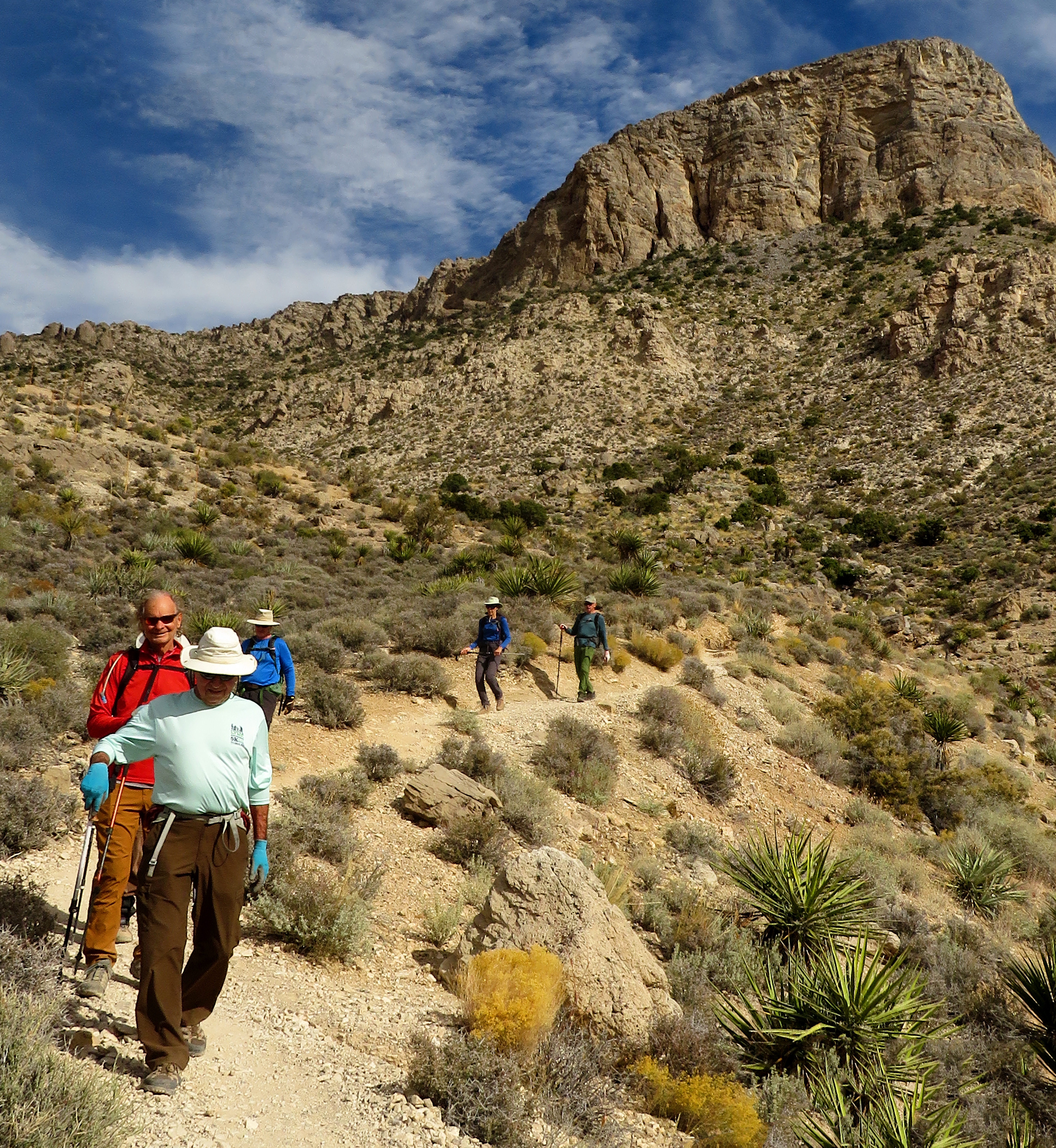
| Trail starting up through the Sandstone |
Turtlehead Peak is a mainstay of Red Rock Canyon NCA. Twelve years ago, the hike up to the top was filled with slippery scree slopes and trails that went every which way. Trail maintenance has improved the experience a lot but there are still many trails. The improvements include large cairns placed in strategic locations to tell hikers which of the many trails should be taken. ... And, still, mistakes can be made. Mistakes will only add time and/or difficult terrain. It is very difficult to get lost. There were no newbies on the hike this time. We were seven hikers strong. ... And, seven strong hikers. Leaving from the Sandstone Quarry Trailhead located on the Red Rock Scenic Loop, we hiked out to where the Turtlehead Trail hung a left.
 |
| View back on Trail |
 |
| The Seven member Team (add the photographer, Mike) |
 |
| Up the limestone Trail |
 |
| Kay Sweeps |
There is a sign here. If you go straight, you will be on the Calico Tanks Trail. Our trail climbs a little berm above the Limestone Wash and dumps you back down. After yearly washouts, the trail still takes hikers up the wide gravel wash to another berm on the other side. Up you go. The trail soon connects you to a trailing ridge that leads all the way up to a saddle that is on the Turtlehead Ridge. Between the trail and the peak, there is a deepish wash. With the wash, the rearview of Cottonwood Valley and the Red Rock escarpment and the towering peak, the scene is beautiful and colorful. Even with the overcast skies of this hike, the scenery could not be quelched. (squelched, quashed) We hiked up the trailing ridge at a steady pace lead by Mike who was watching the large cairns. There are also white blushes on rocks to help with navigation. The trail has a strenuous rating due to the difficult footing of scree and scrambling. We stopped only once when we were almost all the way up to the saddle as the trail begins to level out a bit. After a brief separation, we reconvened on the saddle and turned our efforts to the final peak climb. Of course, hikers can make shorter work of the climb by heading straight to the peak but why would you want to. There are too many views you would bypass.
Stats: ~5 miles; ~2000' gain; ~2.75 hours


No comments:
Post a Comment