Another edition of Club Members' Travels brings us to Zion National Park, smaller parks in Utah and Wyoming, and a huge bicycle race in Iowa.
Kay and John B.

First, Kay and John spent a very relaxing week at Zion. While only hiking a small portion of the Left Fork Subway trail, as seen to the left, the two campers just sat back and enjoyed the beautiful park. The white squirrel in the photo above lived nearby and the photos below were taken in the evening on the Pa'rus Trail. Muggy monsoons were nearby every day but it didn't dampen the pleasure of a well- engineered campsite. A note to future campers: the South Campground is not inundated with aggressive squirrels. Even though it is a first come, first serve campground, if you get there in the morning, especially early in the week, there will be many campsites to choose from. It is also a bit cooler than the Watchman Campground. Kay and John had Site #62 on the Pa'rus Trail and near to the Visitor Center.

 Kay K.

Although this blogger has not been in contact with Kay K., she noticed that Kay K. has been able to update her website with these and many other photos. She has worked her way up through Utah visiting many petroglyph sites and interesting little known parks. She appears to be having a wonderful time and we wish her a continued safe journey.

Included in her travels are the Rochester Panel, UT (photo 1); Fantasy Canyon, UT (photo2); Nine Mile Canyon, UT (photo 3); Flaming Gorge, WY (photo 4). Other places she has visited are the Fremont Indian State Park (UT), Fossil Butte (WY), and Dry Fork RA (UT).
 Mike O'C.

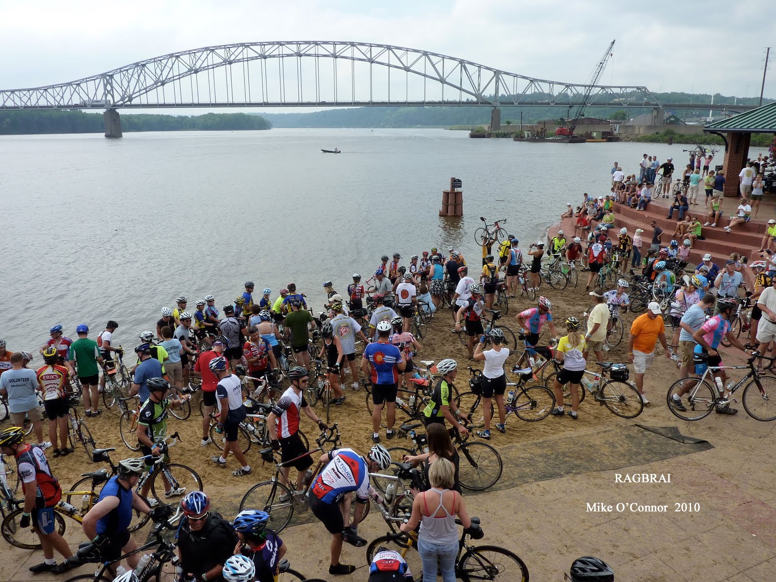
Unless you hike during the week, you may not know Mike O'C., our resident hiker/ bicyclist. Recently, he joined in on a well- attended bicycle race in his old stomping grounds of the great state of Iowa. The race is called RAGBRAI and this was RAGBRAI 2010. Above, Mike teases us with a gorgeous sunrise on an Iowa farm.


The scenery on the race must have been breath- taking as the riders were on the road from sunrise to sunset crossing the state. At the end of July, Mike says the temperatures were in the 90's.


As he passed through, Mike was able to visit some friends in Cherokee, Iowa where they have a mink farm. From Sioux City on the Missouri River to Dubuque, hundreds of bicyclists rode by day and camped by night with a lot of good clean partying in between.


Thanks, Mike, for letting us enjoy the fun vicariously through you. Mike adds, "Good folks, those Hawkeyes. Gotta love 'em."


 There were thirty-six hikers at the parking garage this morning. We added three more at the Visitor's Center in the Spring Mountains on Kyle Canyon Road. And, one more hiker joined us as we passed through the Fletcher View Campground. Sometimes it takes an accountant (i.e. Chris) to figure out how many people to keep up with! From the Visitor's Center, we hiked through the campground and out the other side as we continued to the Rainbow Community entrance. Continuing a bit further up the Kyle Canyon drainage, we stopped for a break just before the trail took a turn upward.
 At this point, the large group of forty divided in half. One half returned to their cars for a three mile out and back hike. The other half continued up the hill to do the full Rainbow Loop of six miles with 1100 feet of elevation gain. The trail passed by the Cathedral Rock Picnic Area and part of the burn area from a couple of months ago. We saw the old shelter on the side of the trail and met up with the South Loop Trail. After hiking a short distance on the South Loop Trail, we turned left onto a trail which led to a small summit above Rainbow where we stopped for our snack break.
 After seeing views of Mummy's Toe Peak, as seen in the photo above, for most of the first half of the hike, we could now see Mt. Charleston and Cathedral Rock, as seen in the first photo, from our purchase at the break. Afterwards, we began our descent on a small woodland trail that all of us agreed is the best part of the hike. It leads down through the trees on a soft dirt path and ends at a weather station in the forest above Rainbow. As we hiked through the shade, one hiker noticed the "Oregon Grapes," as seen in the last photo, on the side of the path. He ate a few and passed some around. They were ripe but tart. We decided to leave the rest of them for the birds!
 When we reached the Rainbow residential section, the trail lead down the road past beautiful summer homes and cabins. The police patrolled the neighborhood as we sauntered along not stopping to admire any one house for too long. We reached the Kyle Canyon drainage at the entrance to Rainbow and returned to our cars by again passing through the campground. The weather was warm and the hike was completed at a leisurely pace.




.jpg)