Monday, September 12, 2022

Mountain Springs Peak / Upper Cairn Trail - 9/11/22

Ralyn checks out the 10am clouds over Mountains

Small Arch at Snack Cliff

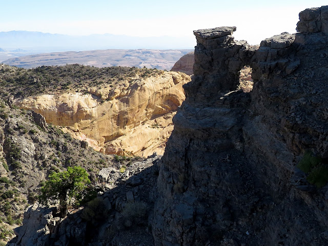
Overview from Rim Trail

Sunrise at Mt. Potosi and Burnt Ridge
We don't get a lot of hurricanes affecting Las Vegas but this week, we had Hurricane (now Tropical Storm) Kay giving us and southern California much needed rain. We diverted our regular summer season mountain hiking down to the high desert of the top of the Red Rock escarpment for just one (?) day. It felt a lot like going home to "check on things!" We started from the Mountain Springs Pass Trailhead which was a bit rutted from much recent rains. Everything was wet and very green. Even the cacti appeared to smile! The temps on top of the escarpment were really nice at around 65 to 70 degrees with an occasional breeze. We'll take that all day! The hike started out with a brisk climb up Heartbreak Hill.

After a Quick hike up to the Saddle

Climbing up to the Fork Junction

Mt. Potosi in Repose through Desert Brush (!)

Passing the Fork Junction
I stopped to take a few photos and was the last to arrive at the saddle. There were just a few puffy clouds over the Spring Mountains and the sun rising on Mt. Potosi was just what the doctor ordered! After a brief breather on the saddle, we continued up the trail to the left toward the fork junction where the Windy Peak Trail veers to the right. The ground was damp and easily hiked. Passing the left turn onto the Lower Cairn Trail and the fork junction, we continued out the Mountains Springs Peak Trail to the rim of the escarpment. The air over the Las Vegas Strip and surrounding valley was very "hazy." (Mostly humidity probably.) We couldn't see any of the hotels very clearly but we could, in fact, see the mountains to the northwest nicely.

View to Mountain Springs and on to Death Valley

Mountain Springs Peak Trail at Shelter Rock

Almost to Peak - Spring Mountains in Distance

Signing in at the Peak
We hiked the peak trail around and up with views of the separate cloud "stations" showing where the rain bands of the storm settled. Essentially, all the higher mountains of Death Valley area, Spring Mountains, and Mt. Potosi had some sort of cloud cover. We were also reminded how beautiful a change in light makes familiar landscapes appear. Around and up past the large shelter rock wall, we hiked until we arrived on top of Mountain Springs Peak (~6639'). This is a high point on the southern end of the escarpment within the limestone layer. It is almost unnoticeable as it rises behind several outstanding sandstone features and peaks of the Keystone Thrust. A log book can be found within a large stone cairn. 
Windy Peak and Cottonwood Valley from Trail

Escarpment Cliffs and Calico Hills from Rim Trail

Neighboring cliffs from Snack Cliff

Snack Cliff from Neighboring Cliff
We signed in and decided to take our break down at the Snack Cliff. The stretch between the peak and the usual break spot is filled with color and magnificent geological views as the rim trail continues right at the edge of the escarpment cliffs. Below us, Black Velvet Canyon laid deeply between Black Velvet Peak and Monument Peak. Behind Monument is Hidden Peak, a peak that we climb from the back every year. At the bottom of the 200' down climb of the rim trail is Snack Cliff, a great place to sit and enjoy the views. Since the humidity covered the Stratosphere, I opted for a different view of the small window in the rock underneath the cliff as seen in the second photo. Bruce's photo shows how the Snack Cliff juts out into the upper elevations of Black Velvet Canyon. We took our group photo and had a snack (!) then started our climb back up toward Mountain Springs Peak. There is a bypass trail that misses the peak and connects back onto the peak trail. We followed the peak trail back to a ridge that drops gently back down toward Mountain Springs, NV. This is where the Upper Cairn Trail tops out. This is the second of two very cairned trails that drop down from the Mountains Springs Peak Trail to the same area.

Bruce returning from Neighboring Cliff

Taking our Break on Snack Cliff

Upper Lovell Canyon from Ridge

Halfway down ridge on Upper Cairn Trail
Bruce led us down through the cairns and soon, we were junctioning with the Lower Cairn Trail as seen in the photo below. As we descended, we saw that the clouds at each "station" were billowing up. We expected all of them to begin dropping rain at the magic 11 o'clock hour. From the Upper/Lower junction, we descended to an old road circle, crossed and connected with a vague trail on the other side. This trail crossed the gulley on the left, followed along an old road above the ranches to the right and, eventually, led us to the shortcut trail leading back to the original beginning of Heartbreak Hill. Beautiful morning in remembrance of the tragic 9/11 attacks.

Stats: 5.3 miles; 1350' gain; 3.25 hours

Upper Cairn and Lower Cairn Trail Junction

Returning on Old Road

Down last hill to Trailhead


No comments: