 |
| River Mountain from Inner Caldera Trail |
 |
| Red Rock Canyon and Spring Mountains behind Las Vegas |
 |
| Lake Mead's Boulder Basin |
 |
| Starting around the Inner Caldera Loop |
The moderately strenuous hikers were chomping at their bits this morning after sitting around over the Thanksgiving holidays through the wind, rain and snow. Our drive over to the Fiesta Henderson was almost unchallenged through the Las Vegas Spaghetti Bowl on this Saturday morning. I guess everyone was readying for a second round of shopping or heading over to Red Rock Canyon. The visitors were not making their great escape from Sin City, as yet, and the HOV lane was totally unnecessary! From there, eleven hikers made their way over to the Bootleg Canyon Bike Park in Boulder City, NV. We made a quick stop at the restrooms located at the base of the zip line then traveled on up the dirt road to the intermediary trailhead parking at a large trail junction. The road was worse for wear after recent rains but was still drivable with a small amount of clearance.
 |
| Down and Up |
There are a few ways to conquer River Mountain, the highest peak in the River Mountain Range west of Boulder City. Years ago, Chuck Hawkins introduced us to the peak by way of the River Mountains Trailhead off of Hwy 93 near St. Jude.
 |
| River Mountain peeks Over |
This route varied in length of at least 8 miles and used sandy washes for part of the trip. It was always a fun hard hike. Sometimes, hikers ran out of steam at the Power Pole Saddle and never made it up to the peak.
 |
| Another Down & Up |
 |
| Passing an Outer Caldera Junction |
So, when I started leading hikers up to the River Mountain Peak, I devised the shortest route I could find that also used trails. (I have this ridiculous love of following trails!) Anyway, so my route uses what the bike park calls the Inner Caldera Loop as a balloon and an out and back route up to the peak as the string. We started onto the Inner Caldera Loop on the left side of the parking area (as you come in to the lot). The trail hangs on the side of the hill with views of the Las Vegas and Sheep Mountain Ranges. Both were covered with snow today. Then, we came to our first obstacle; a very steep hill covered in bedrock. (See the fourth photo.)
 |
| Wide View of Las Vegas and surrounding Mountains |
As the trail hugged the curves of the hillside, Las Vegas and the Spring Mountains came into view. Lots of snow there, too.
 |
| Following a Service Road between Inner and Outer Caldera Junctions |
Our pace had already revved up. Personally, I needed the momentum when tackling the steep ups that came regularly after steep downs. These are characteristics of bike trails in this park.
 |
| Crossing over on the Outer Caldera |
 |
| Can't get enough of the view! |
At the apex of the loop on the northwest end, the Inner Caldera Loop junctioned with the Outer Caldera Loop then we turned to the right. Soon, our loop junctioned with an old dirt road that travels down through a small canyon and heads out toward River Mountain. We turned left on the road to start the "string" portion of the route. You can either stay on the road that will take you all the way up to the Power Pole Saddle or you can take a portion of the Outer Caldera Trail that cuts the corner. Either way is about the same distance. We took the trail then turned left on another road before we reached the road on which we had begun. One good reason to take the trail is that, sometimes, the road is re-graveled and the slog is taxing.
 |
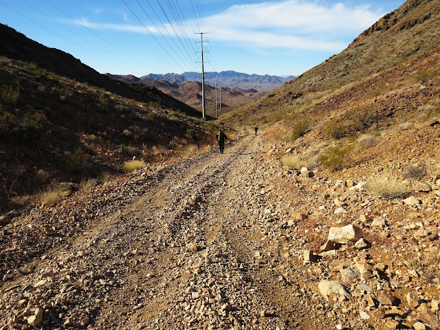
| Climbing the Service Road to the Power Pole Saddle |
At this point, the service road travels up through the power line canyon on a decent slope. At the Power Pole Saddle, there is always a short rest!
 |
| Nearing the Saddle |
It is here that we get the first look at Lake Mead! And, oh what a beautiful view, it is! You can see all of Boulder Basin from the red rocks of the North & South Bowls of Fire to Kingman Wash lagoon and the Marina.
 |
| Steepness Ensues |
 |
| Lake Mead from Ascent to Peak |
The power lines flow from this saddle down toward Hoover Dam. Or, should I say, they emanate from the dam, up and over the saddle and out to Las Vegas and beyond. These are very powerful lines! How can you look at them and see anything but strength and life! We turned to our left and began the hardest part of our climb today. There is somewhat of a trail up through the scree along the ridge. Then, before you reach that first outcropping peak, the trail turns left for a traverse diagonally up to the ridge. We saw many signs of bighorn along this part of the trail. Next, you hit the black igneous rock on the peak. A little bit of scramble sets you atop where the survey markers are along with a grounding wire. We signed into the sad little log book!
 |
| Hikers on the Summit and on Traverse Trail |
This peak has an incredible panoramic view - 360 degrees. There was snow on almost every mountain range to the west, north and northeast. Great day for this!!
 |
| Mt. Potosi from Ridge |
We didn't stay long. I never do since I am always apprehensive about the steep slippery descent. So, after suggesting that everyone take their time going down, about six of us started off the peak.
 |
| Summit Photo |
 |
| Survey Marker |
Over the years, this descent has gotten less daunting for me and our descent went smoothly. Another three hikers were close behind making pretty good time. Then ... there were two hikers that had underestimated the descent and we waited for several minutes for them to get to the saddle. From there, we continued to re-trace our route back to the Inner Caldera Loop at the same place we left it. It was a strong group of hikers so I made the decision to take on the wiggly remaining half of the loop at a fun fast pace. We encountered one biker during this last part of the hike. Since it is a bike park first, the bikers prefer that you move out of their way as quickly as possible!
 |
| 360 degrees of Views from River Mountain Peak |
We did. Then the faster hikers took the lead. They were tearing up those curves! Hiking around the bend and another bend!
 |
| Starting down the Steep Descent |
The back group had their own good pace when we came around the corner and saw that the front group was stopped short by a junction decision.
 |
| Nearing the Power Pole Saddle on the Descent |
 |
| Gathering at a Junction |
The Inner Caldera drops down a last steep hill then crosses a dirt road that seems to offer a way back to the trailhead. As I approached, I indicated to stay on the trail and off they went! Oh, what a fun day! We all needed to blow out our engines a little! Felt good. Needed that. ... I was still last so no one was left behind. The traffic was a little heavier going back through town but no stoppage.
6 miles; 1200 feet elevation gain; 3.25 hours; average moving speed 1.8 mph
 |
| Large Arch above the Inner Caldera Loop |
 |
| Hiking the Inner Caldera Loop |
 |
| Nearing the Trailhead on the Return |


No comments:
Post a Comment