 |
| Jean's Peak (L) and Redstone (R) in Distance |
 |
| View from Pinto Ridge |
 |
| Redstone View from Near Jean's Ridge |
 |
| Starting Out from Trailhead toward Pinto Ridge Peak |
Four hikers went out to explore a route for a new club hike in the Pinto Valley area of Lake Mead NRA. Not knowing what we would encounter, we were prepared and preset cars at Northshore Road's mile markers 22 and 25. The objective of the hike was to climb to the high point of the Pinto Ridge (northwest of Pinto Valley) and make our way along the ridge until we reached Jean's Peak. This is not a simple task since there are several saddles that must be found and negotiated. We began at mile marker 22.
 |
| Deciding Which Wash to Ascend |
Our first priority was to find where to start! We crossed the wide wash over to the south side. There is a colorful wash there. We dropped down into it.
 |
| View Back from Ascent Wash |
Not far along the wash, we found a decent looking ascent wash on the right side and followed it up until we hit a small dry fall and stepped up to the right bank.
 |
| A Few Interesting Things along the Way |
 |
| Ascending the Pinto Ridge Peak - Top Left |
This led us up to a flat area with a deep wash on the left side. Continuing our climb up towards the right, we crossed another wash, climbed until we hit another deep wash, turned up to the left and eventually ended up on top of Pinto Ridge Peak. There, we found an old piece of lumber that had long been torn from its guy wires laying on the ground. There was also a cairn of sorts. The 1.5 mile climb had been short but it was a very warm day so we stopped here for our first break.
 |
| Ascent Views |
On the other side of the peak, we could see Boulder Wash flowing down from Pinto Valley to Lake Mead. In the distance along the ridge to the left, we saw Jean's Peak rising in monster fashion.
 |
| Arriving on the Peak |
During the break, two hikers walked over to take a look at the south side of the mountain. A slippery wash was all that was offered for getting down into Pinto Valley here.
 |
| Summit Pose - Plus Kay |
 |
| Jean's Peak from Pinto Ridge Peak |
We reset the old lumber pole to mark the peak then started down along the ridge toward Jean's Peak. Right away, we had to search for that first saddle crossing. The descent down to it was steep but hikable. There were sheep trails found all along the ridge and we knew that those sheep usually knew the best way to get around so we followed them whenever we could. Down on that first saddle, there were a couple of trails that headed up the next mountain. One hiker chose this route.
 |
| Redstone from Pinto Ridge Peak |
The other three hikers had come down off of Pinto Ridge Peak further down and chose a different sheep trail to gain the next ridge.
 |
| Leaving Pinto Ridge Peak |
The character of today's hike combined the knowledge and deciphering abilities of each of the four hikers. The particular route noted on the tracks below shows what the hiker with the GPS did!
 |
| Descending to First Saddle - Boulder Wash in Background |
 |
| View from First Saddle |
We stayed within sight distance of each other throughout the hike and called to each other when we learned something that was useful to the other three. The canyons that fell from both sides of the saddle were usually very deep so it was important to find those bridges to the next mountain. As we hiked along the next ridge filled with rimrocks, we found another sheep trail. This beautiful intermediary ridge gave us the view in the first photo of the entry.
 |
| Jean's Peak from Pinto Ridge |
Along the way, we saw many beavertail cacti ready to burst into bloom! There were also other types of flowers that were blooming.
 |
| Cirlcing Intermediary Peak |
At the end of the rimrock ridge, we followed sheep trails down to a wide saddle area. Then we were obliged to scramble up to the next ridge peak.
 |
| Chuck Climbs Up from a Saddle |
 |
| Trailhead (MM 22) from Jean's Ridge Ascent |
All along the way, there were points where we could look back and see our car at the trailhead. We continued in this fashion another time while we kept the monster mountain of Jean's Peak in our sights. Finally, we came to the last saddle before the Jean's Peak Ridge. This last ridge presented a long climb up from right to left. The saddle proper basically hit a wall as it crossed over to the mountain so we opted to hike to the right down the wash a little way to a dry fall drop where we surmounted the low ridge and began climbing.
 |
| Anne Climbs Jean's Ridge |
This is a beautiful ridge to climb even if it was long. Views were tremendous! We reached the first high point on the climb and decided to take another long break. We would need our energy for the next part!
 |
| Jean's Ridge High Points |
We were heading straight for the small cairn that we had built on a previous hike coming from the other direction but between us and that cairn, there was a very steep hikable climb.
 |
| Paul Rests at the Tall Cairn on Jean's Peak |
 |
| Redstone and Northshore Road from Jean's Peak |
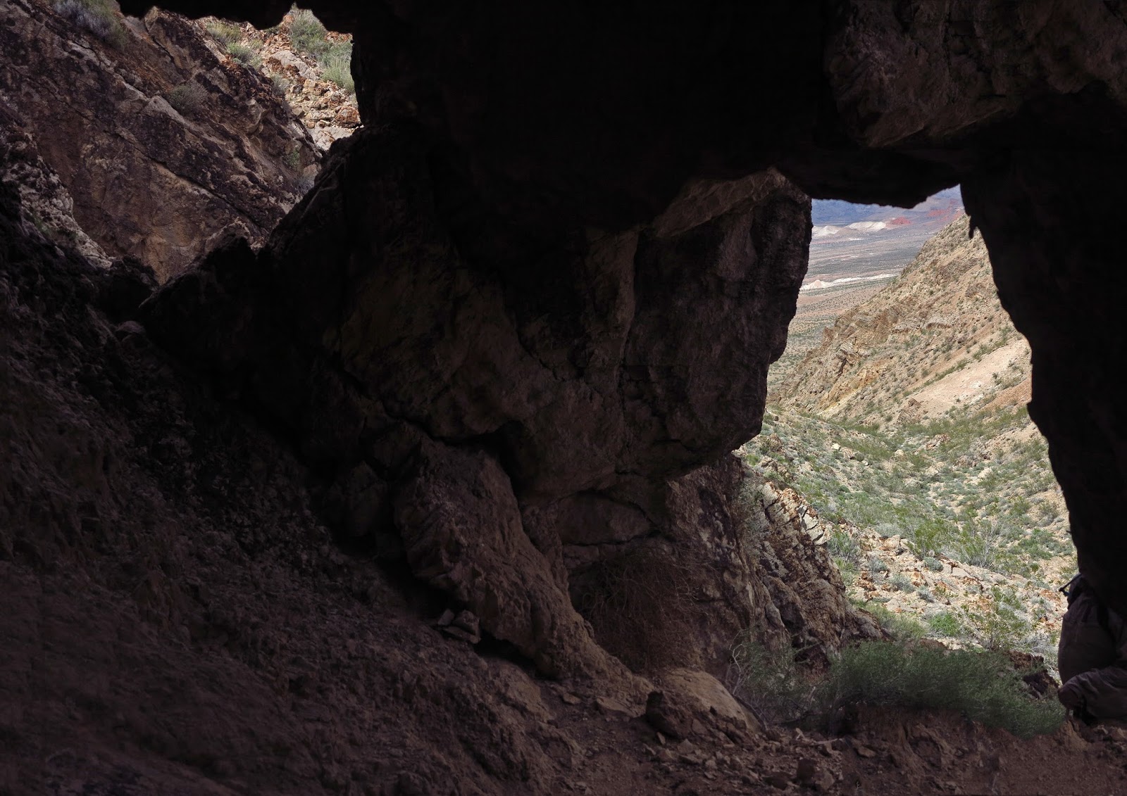
Finally, we reached the small cairn and the slopes became more gentle. We hiked along the ridge until we reached the very tall cairn on the other end. After signing into the log book, we started our descent down to the saddle and around the washes to the last saddle. From there, we hung a left and descended the rocky wash (taking a side trip to the large arch on the left wall) all the way down to Northshore Road. We crossed the road to the car we had left at mile marker 25. This was a great exploratory that should become a yearly hike. You don't get these views anywhere else!
6 miles; 1900 feet elevation gain; 5 hours
 |
| View from Descent off of Jean's Peak |
 |
| Large Arch in Descent Wash |
 |
| Descent Wash and Trailhead (MM 25) Beyond |


1 comment:
Kay--Another great job of presenting and photographing our team's exploratory efforts of yesterday--Thanks !
By the way, did the Bitter Springs Cliff hike today. It was really enjoyable. Might try to get the hike on the ATBF schedule next season.
Chuck H.
Post a Comment