 |
| XL sits atop Fletcher Peak |
 |
| Raintree Roots |
 |
| Mummy's Toe (Charleston Peak Beyond) |
 |
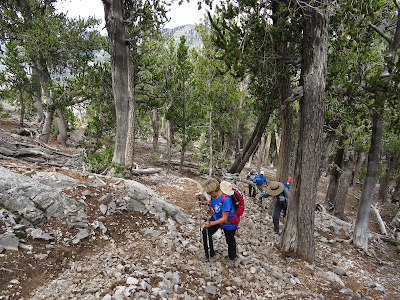
| Hiking up Cougar Ridge Trail |
A great group of twelve hikers came out for a Saturday climb to Fletcher Peak. The route used for today was one of the more strenuous to reach the summit of the diminutive Fletcher Peak. This peak is the smallest of the named peaks in the Spring Mountains NRA at an elevation of 10,262 feet. It is covered with bristlecone trees and other pines and has a unique scarring of limestone down its side. Although Fletcher Peak has a sister peak that is about 2 feet higher, our club and many others stop at the first peak with its beautiful views and rocky top ... and the log book.
Our route started from the Cougar Ridge Trail parking turnout on Deer Creek Road. We exited the cars into the very nicely cooled mountain air. When ready, we began hiking up the dirt road across the highway. This is a residential road called Cougar Ridge Trail. Not far up the road is a gate meant to keep out cars that do not belong up the hill. We ducked under the gate and went on up.
 |
| Mountain Playhouse |
Deer Creek flowed next to the picnic area below us to the right but when the dirt road rose up to meet the creek bed, there was no water above ground until just before we reached the right turn that goes up to the cabins and houses. Here, at the "Keep Out" signs, our route went straight up the canyon and creek bed on a trail.
 |
| Surmounting Deer Creek Ridge |
The resort cabins were up the road to our right past the signs. But soon, we were passing the area where there used to be an old sawmill. Ruins are still there but we didn't go over to them. There are also remains of a couple of old creek dams.
 |
| Morning light at Mummy Springs |
 |
| Deer Creek Ridge from Trail Above |
The Deer Creek Trail is fairly easy to follow. It passes a shelter made of logs and limbs that would pass for a great kids playhouse. After crossing the creek bed a couple of times and going on up the hill, the trail comes to a very large boulder (left of trail) and turns to the right. This is where the route surmounts the neighboring ridge and continues the climb there. (BTW, if you try getting up on the ridge too early, you will be on the wrong ridge!) I enjoyed how the group stayed together today ... even on the ridge ... sort of! We gathered at the top of the ridge where it perpendicularly meets the Mummy's Toe Trail. Next, we turned to the left and hiked over to Mummy Springs.
 |
| Hiking from Springs to Raintree |
We had a lot of climbing in front of us so no one wanted to climb up to the springs to take a look see. But, the area was very pretty in the morning light.
 |
| Water Break at Raintree |
Without even a pause, we continued up the trail to Raintree where we stopped for a water break and to talk to a club member who was there with family.
 |
| Reaching Fletcher Peak Saddle |
 |
| Interesting Addition to the Fletcher Peak Trail |
Our route continued out the North Loop Trail up the hill to the Fletcher Peak Trail junction where some of us made the huge step up the log. (I was one who looked for an alternative!) This trail continues on a traverse around behind the hill then drops severely down to a bare saddle area. When I started hiking up Fletcher Peak (2008), the trail was not apparent. In fact, the first time I went with the club, we ended up climbing a bit too far to the left. Now, the trail is very well trod and easy to follow as it leads up the right side ridge with gorgeous views all along. We laughed when we came to a very odd trail addition at one of the small intermittent saddles. (See photo to the left.) I don't think this is "wilderness legal."
 |
| The Final Ascent to the Fletcher Peak |
After the picket fences, we started up the final ascent to the peak. Everyone was huffing and puffing but still hiking together ... sort of ... and putting on a great show of strength.
 |
| Arriving on Fletcher Peak |
It was a cool day with a small breeze. When we were on the peak, the sky had become somewhat overcast but, all in all, we were very comfortable and enjoyed our break.
 |
| Charleston Peak from Fletcher Peak |
 |
| Enjoying the Summit |
Fletcher Peak is a wonderful overlook peak. Its location affords a view of the complete Kyle Canyon panorama on one side. Then, on the other side, the view extends out to the desert of Nevada. We had all been there before; some of us many times. But, Fletcher Peak will always be likened to an old friend. Something we can always count on to be there.
We took a simple break then went on our way as a group, going down the mountain. So far, we had only seen a handful of other hikers even though the weather was optimal. In fact, we remained the "only ones on the mountain" until we climbed back up that hill from the saddle and rejoined the North Loop Trail. Ahh! We found the people! Getting up early has its perks. For example: being the first ones at the parking areas
and being the first ones on the trails. Yep ... some of us are a little sleepy!!
So after a right turn onto the North Loop Trail from the junction, we climbed again, up to the North Loop's High Point Corner.
 |
| Harris and Griffith Peaks |
There were other hikers resting at the corner so we didn't stop for long. Just made sure everyone was together then continued down the North Loop switchbacks. (It was reminiscent of Thursday's hike on the Bonanza Trail ... but not nearly as long!)
 |
| Descending Fletcher Peak Trail |
We stopped for a short water pause at the top end of the meadow/saddle then turned left onto the Wild Horse Canyon Trail.
 |
| North Loop Trail |
 |
| Descending North Loop Switchbacks |
After crossing over to the canyon, we began the steep descent
avec small switchbacks. Hiking sticks are very useful on this slippery descent. Then, finally, we turned down into the canyon and enjoyed the gentle ride. Large rotted trees have fallen in this canyon recently but the trail has already been diverted. There is one more tree that will likely fall soon. Be careful! What a great day! Excellent route!
6.5 miles; 2300 feet elevation gain; 4 hours
 |
| Columbine Plants in Wild Horse Canyon |
 |
| Entering Narrows of Wild Horse Canyon |
 |
| Almost There! |


No comments:
Post a Comment