Trail and Cascata Waterfall
Railroad Pass Mountain Loop Trail
Another new hike for the Around the Bend Friends Hiking Club of Las Vegas! Coming in at only 4.7 miles with 900 feet of gross elevation gain, the Railroad Pass Mountain Loop is a trail that begins and ends in the upper parking lot of the Railroad Pass Casino in Henderson. The trail loops around above the Cascata Golf Resort and leads the hiker just above their famous waterfall which flows as a beautiful backdrop for their driving range.
Probably the most difficult part of the hike happens in the very beginning as nineteen hikers climbed the hill behind the casino to reach the trail level. A few small switchbacks help in this ascent. Once we reach the trail level, the hike proceeds at an even elevation with only small ups and downs that the bikers so love to challenge themselves with. Although this trail is a mountain bikers' trail, we did not see anyone else on the trail all morning.
Cascata Waterfall and Jug Handle Arch Above Left
Cascata Golf Resort
When we rounded a corner about 45 minutes into the hike, we saw the beautiful waterfall on the opposite side of the small canyon that we would hike around. There is a rumor that the golf course doesn't turn on the water on Tuesdays so be aware of that. High above the driving range, we were out of danger and we had a gorgeous view. Up to our left, on top of the small mountain range, we could see a large jug handle arch.
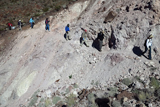
When we got to the other side of this canyon, we hiked above the waterfall on a rock fall with uneven footing. Just be careful here. There is also a vein of white and pink here. Gypsum? Perhaps, but the mineral that put this area on the map was alunite. When alunite was discovered in these mountains, a mining camp was established due to the relationship between alunite and gold. However, gold was not found before the boss ran out of money.
Informational Sign Explaining History of This Area
Climbing the Last Real Hill Before Break
We continued around and we could see the Mother Trail across the way. The high point of the hike was at a point where we were only around 100 feet away from the Mother Trail's apex. We took our break out of the wind while gazing down at the golf course. Afterwards, we wiggled our way down in elevation with expansive views of Las Vegas and the Spring Mountains.
At one point, the hiker is given a choice about whether to go right into the wash or go left down a ridge. We chose right and continued around at desert floor level. The last mile brought us up a level and then we dropped back down to the casino. Everyone enjoyed the new hike and suggested that they would like to do it again someday.
Rock Formation and Trail on Second Half of Loop
Mt. Charleston Peeking Out From Wash


No comments:
Post a Comment