 |
| Anniversary Peak (L) from Upper Level of South Bowl of Fire |
 |
| North and South Bowls of Fire from Anniversary Peak |
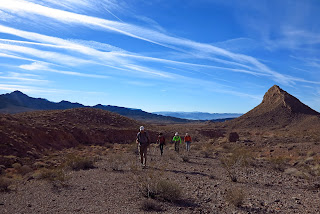 |
| Hiking Out |
It was a very merry Christmas Eve today for nine hikers out at the Lake Mead NRA. We drove out Northshore Road to mile marker 16, turned north down the nice dirt road for a short way to cross Callville Wash Road, then parked on the side before the first wash to the right. We began our hike up this wash and quickly started a trek overland in the general direction of a small valley between a red and black ridge on the left and small but strong Murphy Peak on the right.
 |
| Crack Climb Indicated by Arrow (Murphy Peak to R) |
Our cross country trek was forced into a central wash for part of the time to avoid dipping into cross washes on the way. At one point, the wash route required a non-intuitive sharp turn to the right to stay in the main wash.
 |
| The Crack Climb |
 |
| View Down During Crack Climb |
The target crack that we wished to climb on the left side ridge has two options. Our option was to climb the crack on the left side of the uprise containing the arch. This side is easily climbed in a stair-stepping style. The right side of the uprise is a true crack that may give some hikers some contained comfort. Nevertheless, we all enjoyed the scramble. It is important that the climb stops at the red rock and not continue up to the hills beyond. At the red rock level, we turned to the right and made our way out to the upper level of the South Bowl of Fire.
 |
| Cut Across to Upper Level of South Bowl of Fire |
We hiked this upper red level basically along the cliff to the right even though we didn't have to get very close to it unless we wanted to see a view. It is necessary to stay on this side so that you don't miss the obvious trail that leads into a rocky wash to climb the peak.
 |
| Large Cairn Indicating Usual Down Climb to South Bowl Floor |
 |
| Climbing the Rocky Wash to the Peak |
The rocky wash trail is marked at the bottom with a very large cairn. This is also where some hikers choose to descend to the floor of the valley. There is a fairly clear trail that leads up the wash. Twice it is necessary to climb a short wall to the next level of the wash. Both times, the trail swings around to the left side to make the step up. At the top of the wash, there is still more climbing to do. Heading straight up is the best option. There is a very long drop to the right so it is best to stay away from the edge.
 |
| Hiking Up to Peak from Rocky Wash |
The climb to the peak is steep but you seem to arrive sooner than you think you will.
 |
| The Remaining Climb to the Peak |
 |
| South Bowl of Fire from Anniversary Peak |
At the top, we were straddling the sharp edge of Lovell Ridge. Our peak du jour was known as Lovell Peak for a very long time by hikers gone by. Now, hikers refer to this peak as Anniversary Peak and/or Anniversary Narrows Peak. The writer could not get a confirmation on any one name. Whatever the name, the view from the top is unmatched for miles around. We sat in the perfect weather and stared for some time at the color below us and the lake in the distance. Just gorgeous!
 |
| Enjoying a Super Christmas Eve on the Peak |
We passed around Christmas goodies while we waited for everyone to reach the peak and sign into the log book.
 |
| Starting Down the Precarious Ridge |
 |
| One Trail Option to Saddle |
After the break, it was time to face the music and make the precarious descent to the ridge's saddle. This involves balancing on "sticky" rocks and boulders then carefully stepping on slippery loose stuff high above the valley floor. There are a couple of options here. Our best advice to each other was "just be careful!" Slowly, we finished the down climb and arrived at the wide saddle. With a last look at the South Bowl, we turned to our left and began another slippery down climb on a connecting ridge trail.
 |
| Murphy Peak from Near Saddle |
This ridge trail would take us all the way down to the washes below. These are the washes that fed into the Anniversary Narrows.
 |
| Trail Down Ridge from Saddle to Washes |
 |
| Anniversary Narrows from Bottom of Ridge Trail |
At the bottom of the ridge trail, we dropped into the nearest wash and went down. We named this small wash "Many Cairn Wash" last year due to the large amount of cairns that people have built within the wash to indicate direction. Although we only had to go "down," the cairns were most likely for hikers going up wash. This is a bit more difficult to navigate. Our small wash eventually fed into a larger wash which also fed into another large wash.
 |
| Dodging the Rocks in Many Cairn Wash |
This final large wash fed into the one and only Anniversary Narrows. This beautiful geologic feature was made by many eons of water washing through the relatively small space between two mountains.
 |
| Anniversary Narrows |
 |
| Anniversary Narrows |
It matters not how many times one sees the Narrows. It always amazes! But, for one of our hikers today, it was the first time. When Roger was pushed to comment on what he had just hiked through at the other end, he was nearly speechless! "Beautiful," he exclaimed. 'Nuff said.
We exited the narrows without meeting any other hikers in the popular attraction.
 |
| Anne in Anniversary Narrows |
A short way down from the exit, we turned to the left in a wash that
zigzagged up to a saddle. Near the end of the hike, it seemed steep but
this was going to decrease the length of the hike by around a mile. The
longer option was to return by way of the road. We made one mistake
within the wash. A left fork should be taken about 2/3 of the way up to
the top. No worries. Our right fork provided a previously done up and
over to get back on track.
 |
| Climbing the Wash Out from Lovell Wash near Narrows |
 |
| Saddle Area at Top of Exit Wash |
From the saddle, we descended through a wash to an area that the mining company uses for maintenance purposes. Trying to make a beeline to the cars from this point, we used the wash in front of us until we passed a large wash coming in from the left. At the next best place, we climbed out and found a nice gentle ridge that we followed almost all the way back to the cars. Todays statistics: 7.5 miles; 1800 feet elevation gain; 5.5 hours.
 |
| Ridge Leading Back to Cars |
 |
| Very Large Tortoise Hole on Ridge Return |


No comments:
Post a Comment